MyTopo
Perry NE Missouri US Topo Map
Couldn't load pickup availability
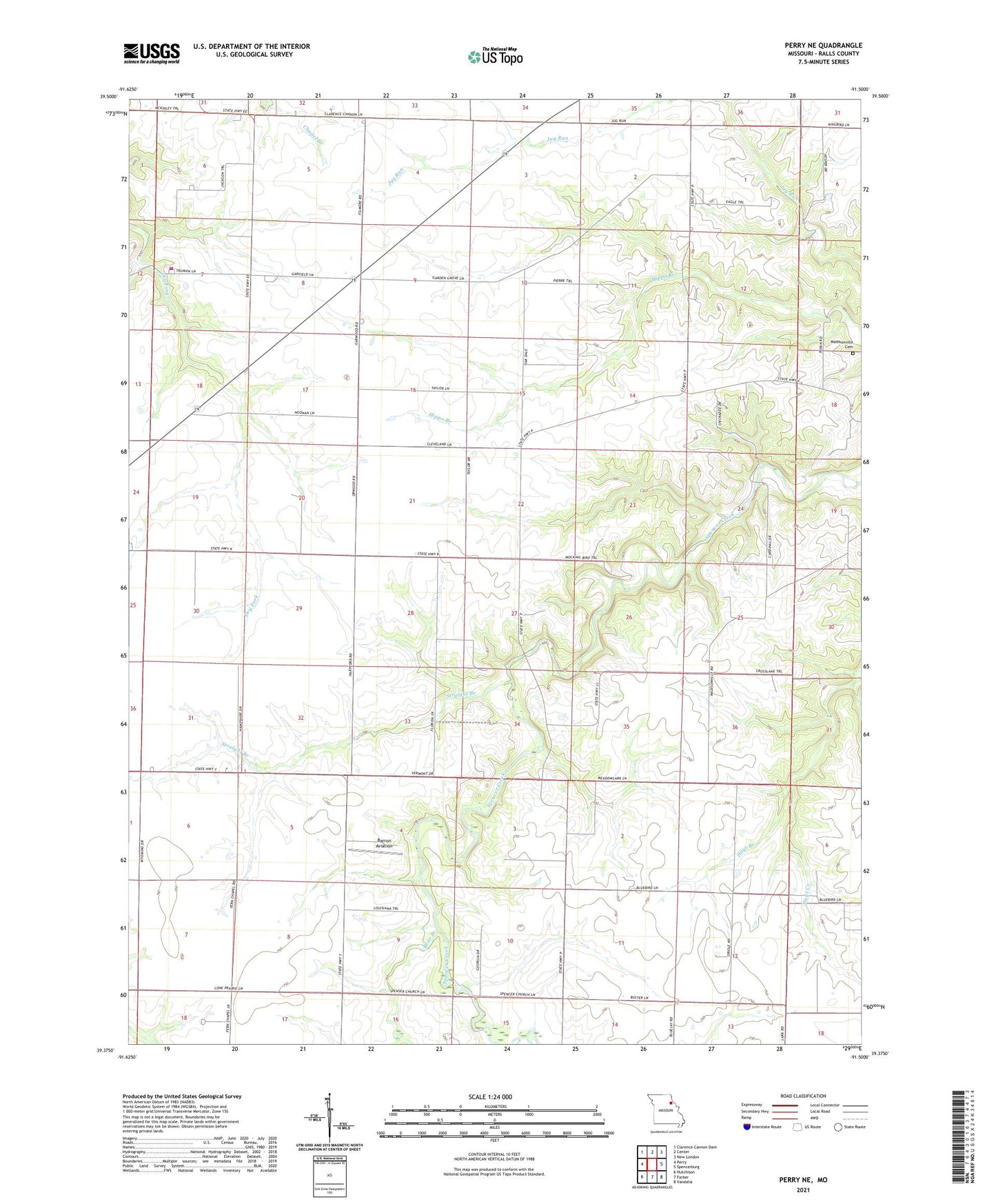
2021 topographic map quadrangle Perry NE in the state of Missouri. Scale: 1:24000. Based on the newly updated USGS 7.5' US Topo map series, this map is in the following counties: Ralls. The map contains contour data, water features, and other items you are used to seeing on USGS maps, but also has updated roads and other features. This is the next generation of topographic maps. Printed on high-quality waterproof paper with UV fade-resistant inks.
Quads adjacent to this one:
West: Perry
Northwest: Clarence Cannon Dam
North: Center
Northeast: New London
East: Spencerburg
Southeast: Vandalia
South: Farber
Southwest: Hutchison
This map covers the same area as the classic USGS quad with code o39091d5.
Contains the following named places: Barron Aviation, Bear Branch, Beaver Dam Presbyterian Church, Butler School, Cross Lanes School, Fern Chapel, Frazier School, Hays Branch, Hays Creek, Jessamine, Lone Prairie School, Madisonville Cemetery, Noonan, Oakdale School, Orwood, Perry Rural Fire Protection Association, Spencer Creek Church, Straight Branch, Swell Head School, Township of Jasper, Union Chapel, West Hartford, West Hartford School