MyTopo
Vista Missouri US Topo Map
Couldn't load pickup availability
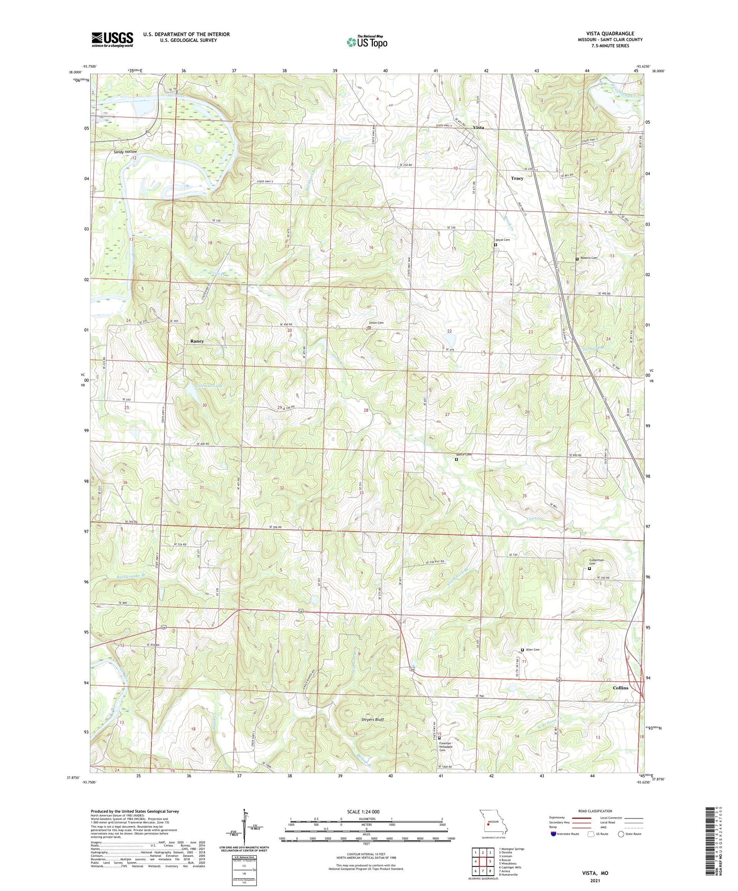
2021 topographic map quadrangle Vista in the state of Missouri. Scale: 1:24000. Based on the newly updated USGS 7.5' US Topo map series, this map is in the following counties: St. Clair. The map contains contour data, water features, and other items you are used to seeing on USGS maps, but also has updated roads and other features. This is the next generation of topographic maps. Printed on high-quality waterproof paper with UV fade-resistant inks.
Quads adjacent to this one:
West: Roscoe
Northwest: Monegaw Springs
North: Osceola
Northeast: Iconium
East: Weaubleau
Southeast: Humansville
South: Arnica
Southwest: Caplinger Mills
Contains the following named places: Allen Cemetery, Ashworth School, Bishop Branch, Bradford School, Brush Creek, Buckhart Branch, Cannon Branch, Coleman Lake, Colemans Valley Lake Dam, Coon Creek, Culbertson Cemetery, Doyal Cemetery, East Branch Coon Creek, Elliot Lake Dam, Freeman - Holsapple Cemetery, Jackson School, Long Ridge School, Nance Cemetery, Oak Grove Church, Peterman Airport, Pleasant Hill School, Prairie School, Raney, Roberts Cemetery, Sandy Hollow, Shady Nook School, Shryers Bluff, Southwick Branch, Topper, Tower Grove School, Township of Doyal, Tracy, Union Cemetery, Union School, Valley Church, Village of Vista, Vista, Vista School, West Branch Coon Creek, ZIP Code: 64738