MyTopo
Weaubleau Missouri US Topo Map
Couldn't load pickup availability
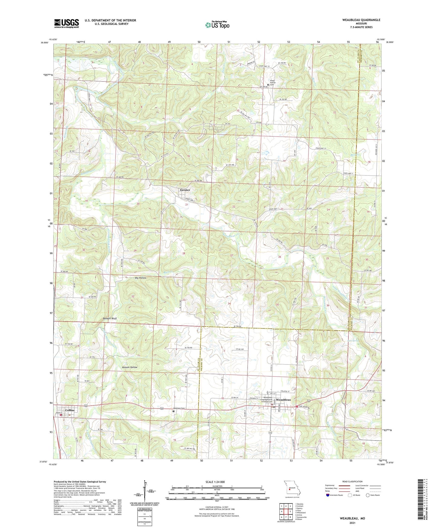
2021 topographic map quadrangle Weaubleau in the state of Missouri. Scale: 1:24000. Based on the newly updated USGS 7.5' US Topo map series, this map is in the following counties: St. Clair, Hickory. The map contains contour data, water features, and other items you are used to seeing on USGS maps, but also has updated roads and other features. This is the next generation of topographic maps. Printed on high-quality waterproof paper with UV fade-resistant inks.
Quads adjacent to this one:
West: Vista
Northwest: Osceola
North: Iconium
Northeast: Quincy
East: Wheatland
Southeast: Elkton
South: Humansville
Southwest: Arnica
This map covers the same area as the classic USGS quad with code o37093h5.
Contains the following named places: Arkansas School, Big Hollow, Boswell Bluff, Burgess School, City of Weaubleau, Clear Creek, Climax School, Collins, Collins Fire Department, Collins Post Office, Cross Roads School, Gerster, Gerster Baptist Church, Gerster School, Gum Spring, Kings Prairie, King's Prairie Cemetery, Kings Prairie Church, Kings Prairie School, Kings Prairie State Public Access, Little Weaubleau Creek, Mount Victory School, Oak Grove School, Oak Ridge School, Possum Hollow, Robinson Cemetery, Rock Creek, South Fork Weaubleau Creek, Tanyard Branch, Terry, Terry Post Office, Town of Gerster, Township of Dallas, Village of Collins, Weaubleau, Weaubleau Congregational Christian Cemetery, Weaubleau Congregational Christian Church, Weaubleau Fire Department, Weaubleau Post Office, Weaubleau R3 High School, Weaubleau R3 School