MyTopo
Roscoe Missouri US Topo Map
Couldn't load pickup availability
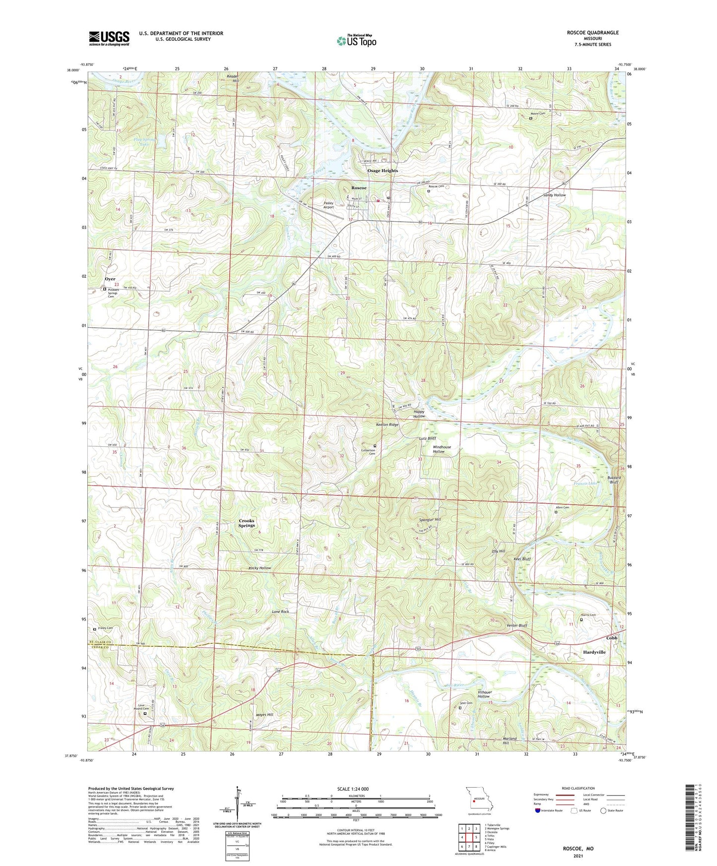
2021 topographic map quadrangle Roscoe in the state of Missouri. Scale: 1:24000. Based on the newly updated USGS 7.5' US Topo map series, this map is in the following counties: St. Clair, Cedar. The map contains contour data, water features, and other items you are used to seeing on USGS maps, but also has updated roads and other features. This is the next generation of topographic maps. Printed on high-quality waterproof paper with UV fade-resistant inks.
Quads adjacent to this one:
West: Tiffin
Northwest: Taberville
North: Monegaw Springs
Northeast: Osceola
East: Vista
Southeast: Arnica
South: Caplinger Mills
Southwest: Filley
This map covers the same area as the classic USGS quad with code o37093h7.
Contains the following named places: Allen Branch, Allen Cemetery, Baker Branch, Bazzill Branch, Blackjack Access, Buzzard Bluff, Cobb, Cole Branch, Coon Creek, Crooks Springs, Culbartson Cemetery, Eby Hill, Flag Spring Lake, Fraley Cemetery, Francis Lake, Green Valley Community Center, Green Valley School, Happy Hollow, Hardyville, Haynie Branch, Keel Bluff, Keeton Ridge, Keetons Lake Dam, Ladden Branch, Lone Rock, Love Mound Cemetery, Lutz Bluff, Macy, Marland Hill, Mayes Hill, Metcalf Branch, Moore Branch, Moore Cemetery, Mottley School, Mount Olive Church, New Oyer, Norris Cemetery, Osage Heights, Oyer, Pasley Airport, Phillips Branch, Piper Ford, Pleasant Springs Cemetery, Rattlesnake Branch, Riverview Bible Church, Riverview Bible School, Rocky Hollow, Rocky Point School, Roscoe, Roscoe Cemetery, Roscoe Elementary School, Roscoe Township Volunteer Fire Department, Seat Cemetery, Shady Grove School, Spangler Hill, Story, Story Post Office, Township of Roscoe, Venter Bluff, Vilhauer Branch, Vilhauer Hollow, Village of Roscoe, Virginia School, Windhouse Hollow, Yarnell Branch, ZIP Code: 64781