MyTopo
Warrensburg West Missouri US Topo Map
Couldn't load pickup availability
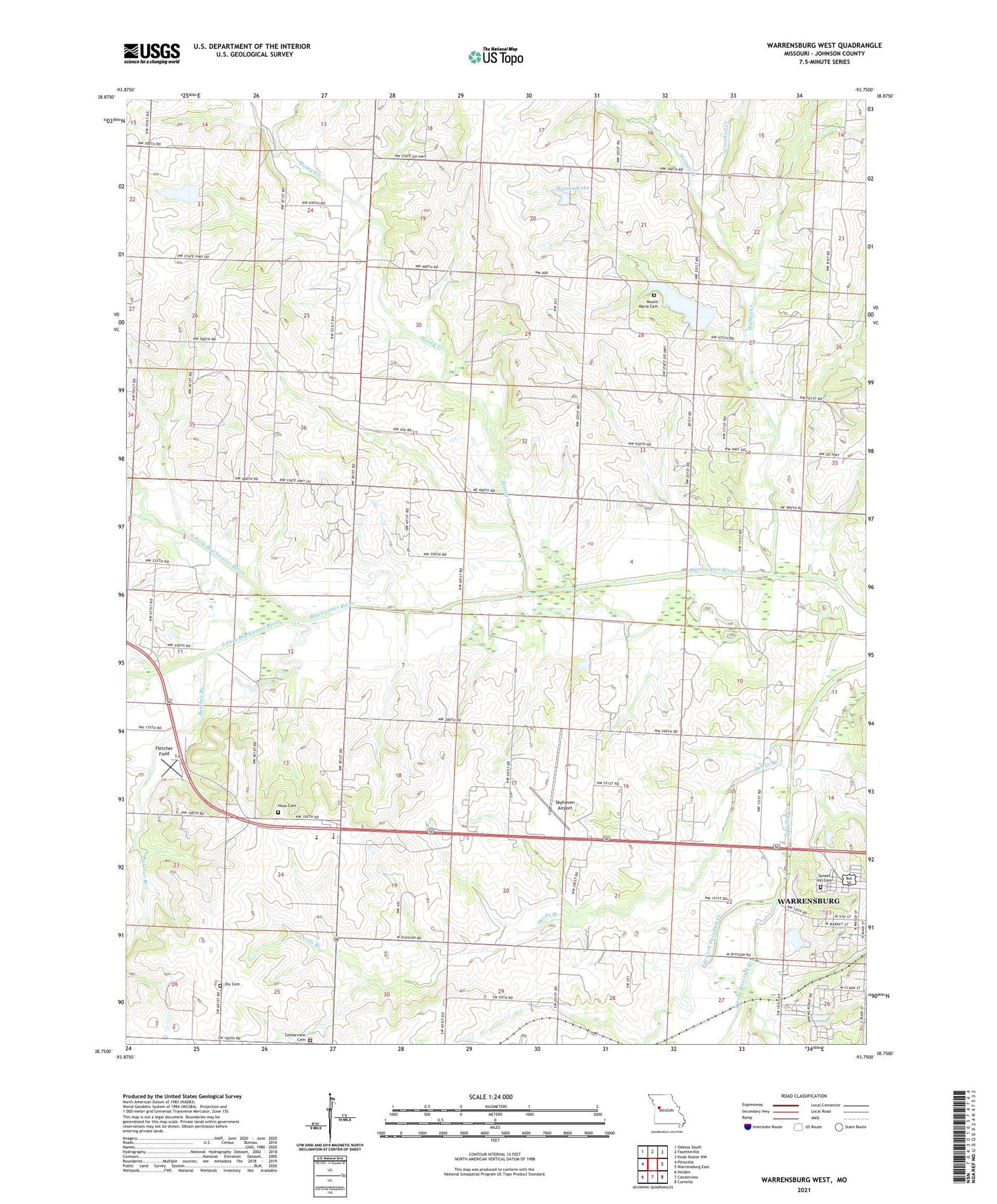
2021 topographic map quadrangle Warrensburg West in the state of Missouri. Scale: 1:24000. Based on the newly updated USGS 7.5' US Topo map series, this map is in the following counties: Johnson. The map contains contour data, water features, and other items you are used to seeing on USGS maps, but also has updated roads and other features. This is the next generation of topographic maps. Printed on high-quality waterproof paper with UV fade-resistant inks.
Quads adjacent to this one:
West: Pittsville
Northwest: Odessa South
North: Fayetteville
Northeast: Knob Noster NW
East: Warrensburg East
Southeast: Cornelia
South: Centerview
Southwest: Holden
Contains the following named places: Butcher Branch, Crest Ridge High School, Crest Ridge Middle School, Crooked Creek, Devils Branch, Dix Cemetery, East Fork Post Oak Creek, Fletcher Field, Green Door School, Greendoor, Greendoor Post Office, Hamilton Lake, Hamilton Lake Dam, Honey Creek, Houx Cemetery, Houx School, Jacoby Chapel, Long Prairie School, Maxson Lake, Maxson Lake Dam, McMahan School, Mount Maria Cemetery, North Fork Blackwater River, Pleasant View School, Sky Haven Lake, Skyhaven Airport, Skyhaven Lake Dam, South Fork Blackwater River, Sunset Hill Cemetery, Township of Centerview, Waldon School, Walnut Creek, Warrensburg Country Club Lake Dam, West Fork Post Oak Creek, Yukon Lake Dam, ZIP Code: 64019