MyTopo
Cornelia Missouri US Topo Map
Couldn't load pickup availability
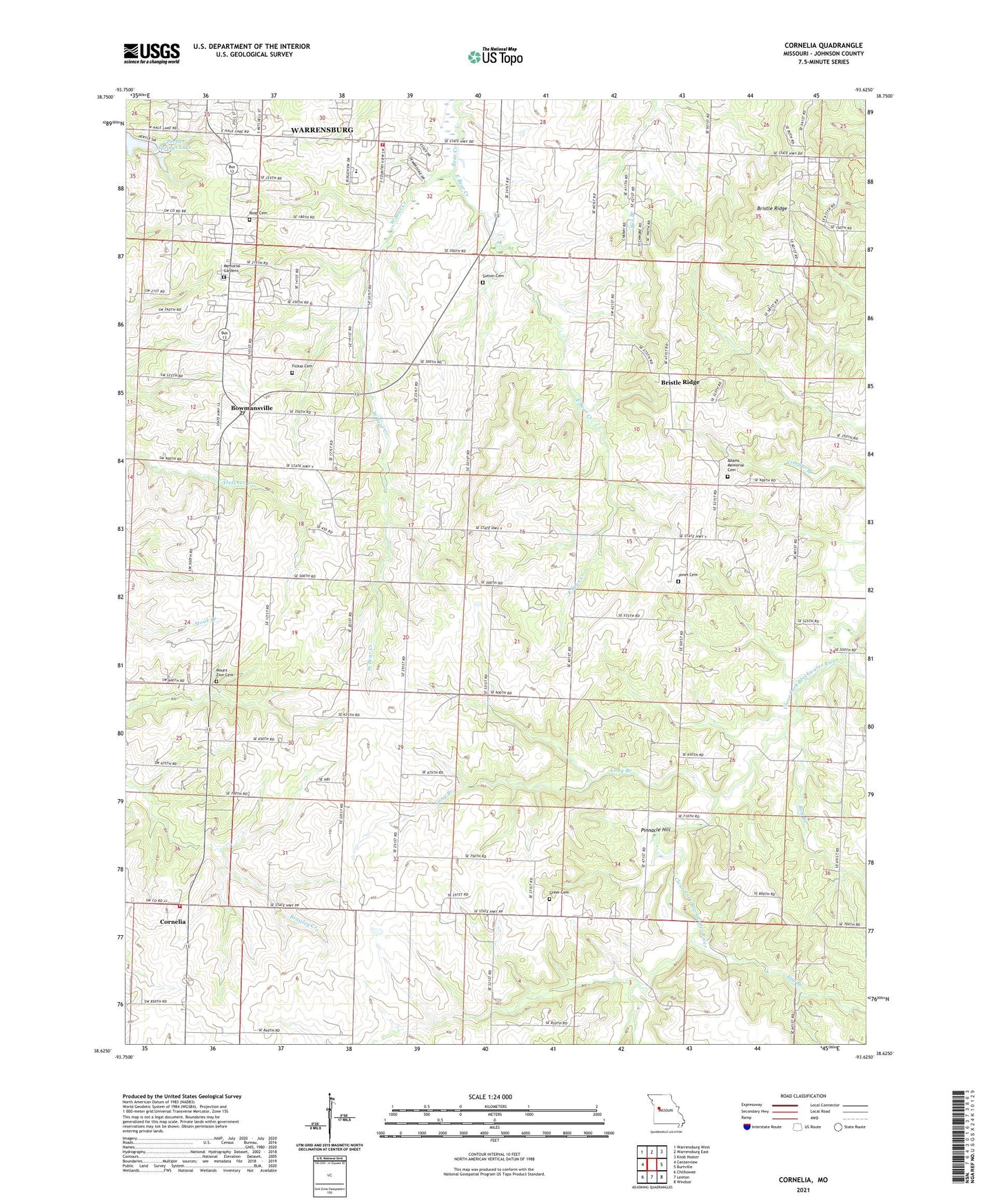
2021 topographic map quadrangle Cornelia in the state of Missouri. Scale: 1:24000. Based on the newly updated USGS 7.5' US Topo map series, this map is in the following counties: Johnson. The map contains contour data, water features, and other items you are used to seeing on USGS maps, but also has updated roads and other features. This is the next generation of topographic maps. Printed on high-quality waterproof paper with UV fade-resistant inks.
Quads adjacent to this one:
West: Centerview
Northwest: Warrensburg West
North: Warrensburg East
Northeast: Knob Noster
East: Burtville
Southeast: Windsor
South: Leeton
Southwest: Chilhowee
This map covers the same area as the classic USGS quad with code o38093f6.
Contains the following named places: Adams Memorial Cemetery, Adams School, Aubrey, Aubrey Post Office, Bell Branch, Bethel Church, Bowmansville, Bristle Ridge, Coperas Creek, Cornelia, Crab Orchard Church, Crab Orchard School, Dawson School, East Bear Creek, Epp Branch, Fickas Cemetery, Futurama Lake Dam, Greer Cemetery, Harmony Church, Hickory Hills Lake, Hickory Hills Lake Dam, Johnson County Fire Protection District Station 10, Johnson County Fire Protection District Station 9 Cornelia, Jones Cemetery, Kallstrom Lake, Kallstrom Lake Dam, Lone Star School, Long Branch, Memorial Gardens, Mineral Creek, Mount Zion Cemetery, Mount Zion Church, Oakland School, Pertle Springs, Pertle Springs Lake, Pinnacle Hill, Roop Cemetery, Sprout Lake, Sutton Cemetery, Teefly Lake Dam, Teller Lake Dam, Union Point School, Valley School, Warrensburg High School, West Bear Creek