MyTopo
Williamsville Missouri US Topo Map
Couldn't load pickup availability
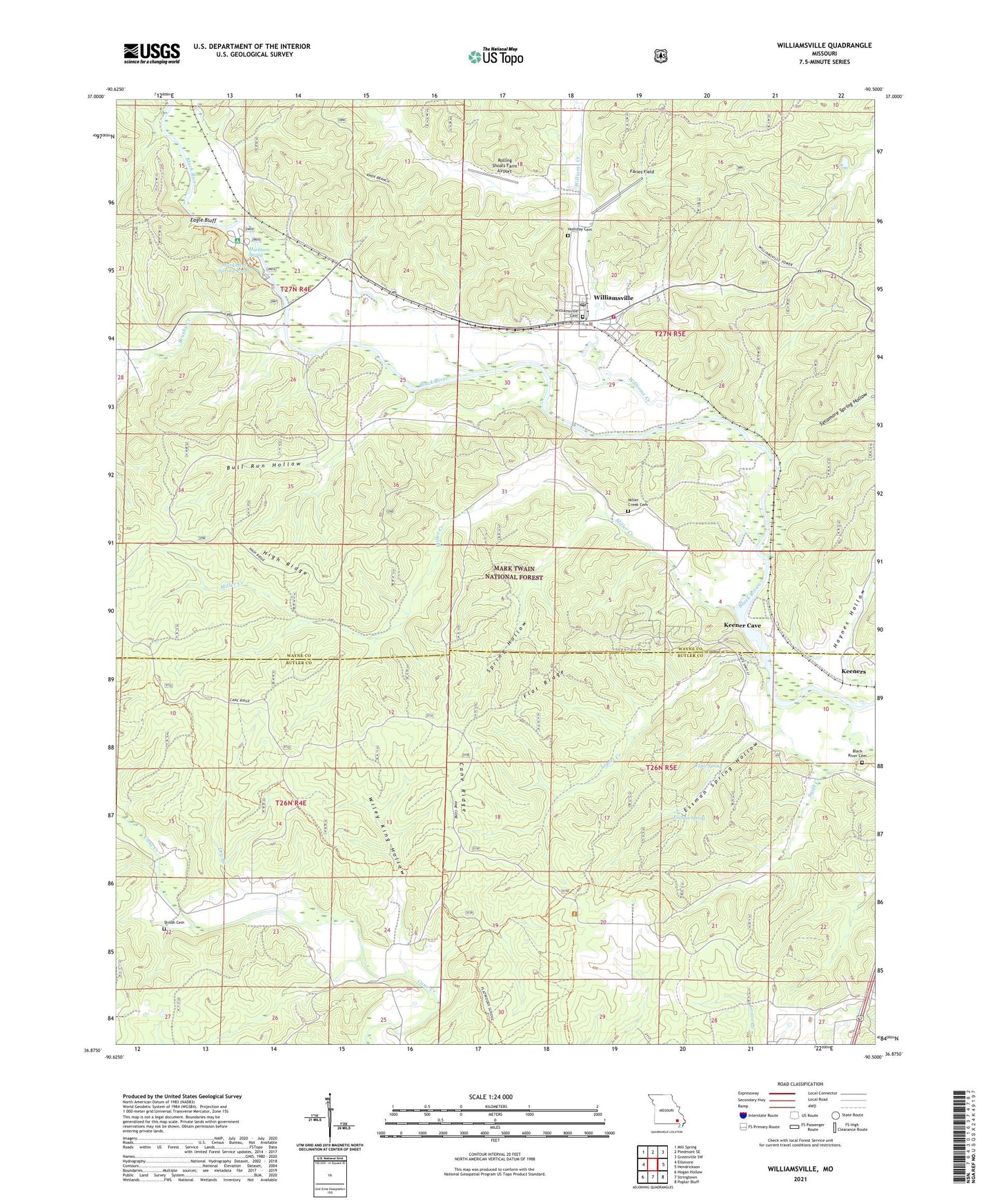
2021 topographic map quadrangle Williamsville in the state of Missouri. Scale: 1:24000. Based on the newly updated USGS 7.5' US Topo map series, this map is in the following counties: Wayne, Butler. The map contains contour data, water features, and other items you are used to seeing on USGS maps, but also has updated roads and other features. This is the next generation of topographic maps. Printed on high-quality waterproof paper with UV fade-resistant inks.
Quads adjacent to this one:
West: Ellsinore
Northwest: Mill Spring
North: Piedmont SE
Northeast: Greenville SW
East: Hendrickson
Southeast: Poplar Bluff
South: Stringtown
Southwest: Hogan Hollow
Contains the following named places: Barrett Mine, Black River - Williamsville Volunteer Fire Department, Black River Cemetery, Black River School, Blum, Browns Crossing, Brushy Creek, Bull Run Camp, Bull Run Hollow, Cane Ridge, Carters Spur, Cave Resort, City of Williamsville, Dry Branch, Eagle Bluff, Elder Spring, Emmatrade Lake, Essman Spring, Essman Spring Hollow, Faries Field, Flat Ridge, Flatwoods School, Haynes Hollow, High Ridge, Holliday Cemetery, Keener Cave, Keeners, Ligett Creek, Lone Star Church, Lone Star School, Markham Spring, Markham Spring Pond, Markham Spring Recreation Area, Markham Springs Dam, Markham Springs Reservoir, Miller Creek, Miller Creek Cemetery, Miller Creek School, New Prospect School, Poplar Bluff Ranger District, Rolling Shoals Farm Airport, Shiloh Cemetery, Shiloh School, Skyway Ranch Landing Strip, Spring Hollow, Sycamore Spring Hollow, Township of Cane Creek, Township of Williams, Upalika Pond, Wiley King Hollow, Williams Creek, Williamsville, Williamsville Lookout Tower, Williamsville Post Office