MyTopo
Hogan Hollow Missouri US Topo Map
Couldn't load pickup availability
Also explore the Hogan Hollow Forest Service Topo of this same quad for updated USFS data
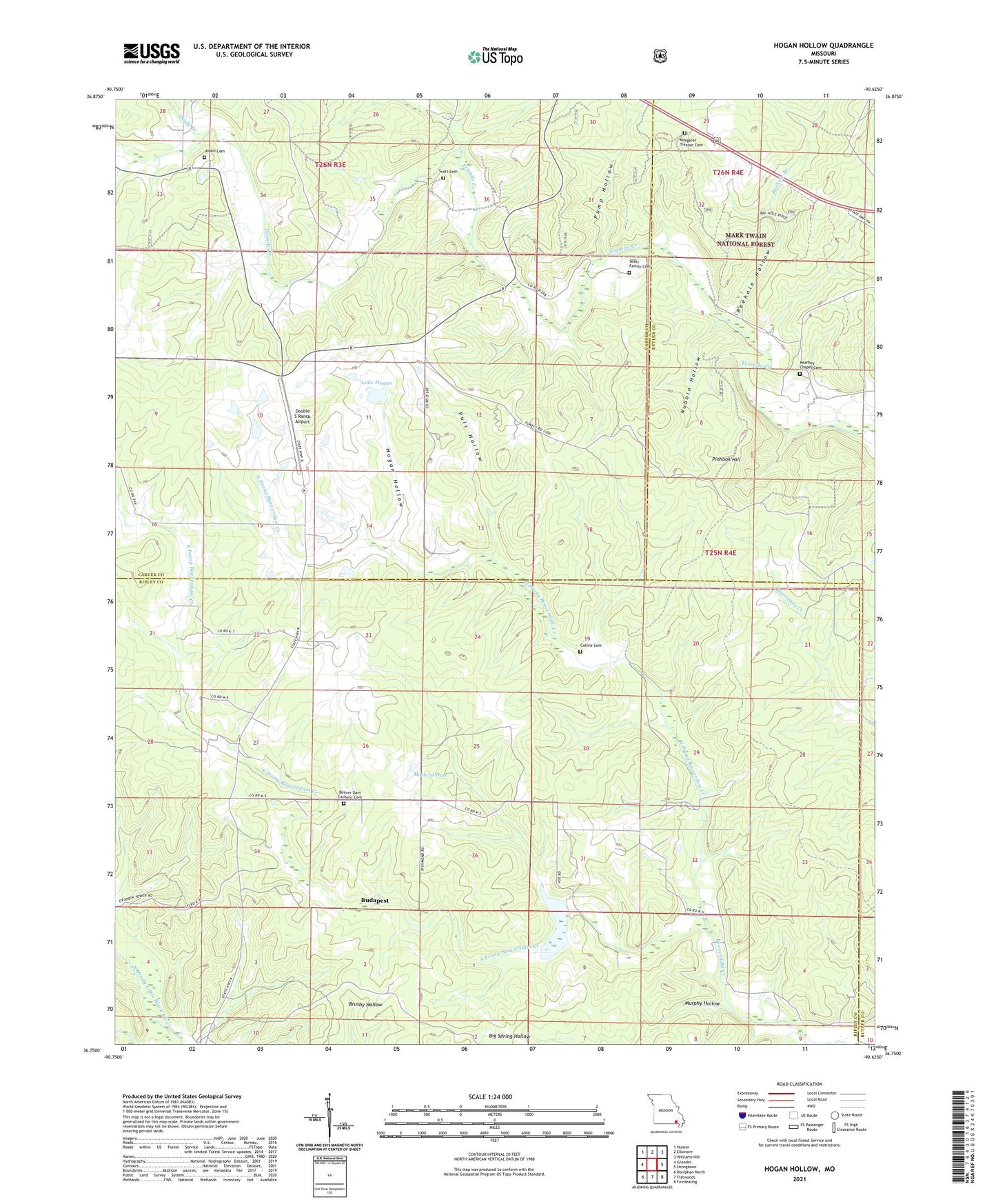
2021 topographic map quadrangle Hogan Hollow in the state of Missouri. Scale: 1:24000. Based on the newly updated USGS 7.5' US Topo map series, this map is in the following counties: Ripley, Carter, Butler. The map contains contour data, water features, and other items you are used to seeing on USGS maps, but also has updated roads and other features. This is the next generation of topographic maps. Printed on high-quality waterproof paper with UV fade-resistant inks.
Quads adjacent to this one:
West: Grandin
Northwest: Hunter
North: Ellsinore
Northeast: Williamsville
East: Stringtown
Southeast: Fairdealing
South: Flatwoods
Southwest: Doniphan North
This map covers the same area as the classic USGS quad with code o36090g6.
Contains the following named places: Beaver Dam Catholic Cemetery, Beaver Dam Church, Beaver Lake Dam, Beaverdam, Beehole Branch, Beehole Hollow, Budapest, Collins Cemetery, Double S Ranch Airport, Doyle Branch, Emmons School, Grandin Lookout Tower, Hogan Hollow, Hogan Hollow School, Homestead, Kearbey Chapel Cemetery, Kearby Chapel, Lake Hogan, Lake Hogan Dam, Lower Tenmile School, Mallard Dam, Mallard Lake Dam, Margaret Treanor Cemetery, Mb Ranch Airport, Murphy Hollow, New Hope Church, North Prong Beaverdam Creek, Nubbin Hollow, Pine Valley School, Pine View School, Pinhook Hill, Puls Hollow, Pump Hollow, Scott Cemetery, South Prong Beaverdam Creek, State Public Hunting Area, Thompson Chapel