MyTopo
Winigan Missouri US Topo Map
Couldn't load pickup availability
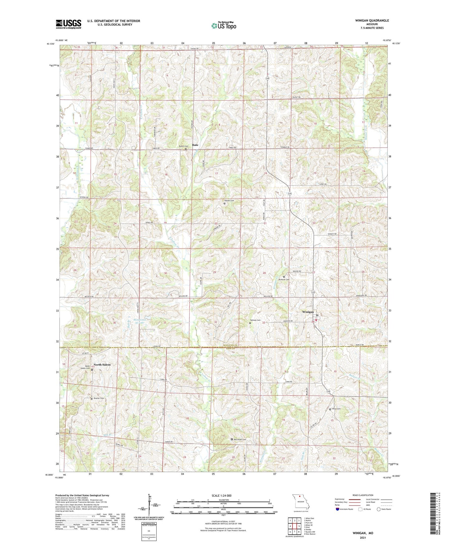
2021 topographic map quadrangle Winigan in the state of Missouri. Scale: 1:24000. Based on the newly updated USGS 7.5' US Topo map series, this map is in the following counties: Sullivan, Linn. The map contains contour data, water features, and other items you are used to seeing on USGS maps, but also has updated roads and other features. This is the next generation of topographic maps. Printed on high-quality waterproof paper with UV fade-resistant inks.
Quads adjacent to this one:
West: Milan SE
Northwest: Milan East
North: Mystic
Northeast: Pure Air
East: Nind
Southeast: New Boston
South: Bucklin NW
Southwest: Shelby
Contains the following named places: Brantner Lake Dam, Bunch Cemetery, Bute, Chaplin School, East Winigan School, Fairview Church, Haines Cemetery, John Branch, Lone Star School, McCollum Cemetery, Mononame 43 Lake, Morris School, Mount Olive School, North Salem, North Salem Cemetery, North Salem School, Peavler Cemetery, Pickerel Cemetery, Price Cemetery, Rose Hill School, Sedgwick, Sedgwick Post Office, Tallman Cemetery, Township of Morris, Township of North Salem, Union Baker Church, Winigan, Winigan Census Designated Place, Winigan Post Office, Winigan Rural Fire Department, ZIP Code: 63566