MyTopo
Alpine Montana US Topo Map
Couldn't load pickup availability
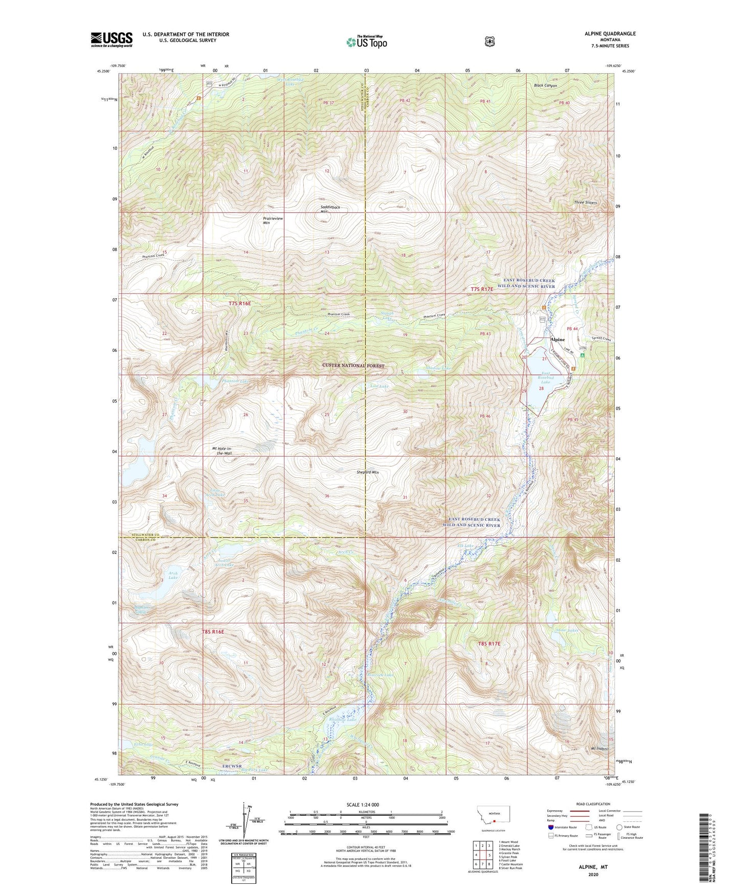
2020 topographic map quadrangle Alpine in the state of Montana. Scale: 1:24000. Based on the newly updated USGS 7.5' US Topo map series, this map is in the following counties: Carbon, Stillwater. The map contains contour data, water features, and other items you are used to seeing on USGS maps, but also has updated roads and other features. This is the next generation of topographic maps. Printed on high-quality waterproof paper with UV fade-resistant inks.
Quads adjacent to this one:
West: Granite Peak
Northwest: Mount Wood
North: Emerald Lake
Northeast: Mackay Ranch
East: Sylvan Peak
Southeast: Silver Run Peak
South: Castle Mountain
Southwest: Fossil Lake
Contains the following named places: Alpine, Alpine Post Office, Arch Creek, Arch Lake, Armstrong Creek, Beartooth Mountains, Big Park Lake, Chicken Creek, Custer National Forest, East Rosebud Campground, East Rosebud Creek Wild and Scenic River, East Rosebud Lake, Echo Lake, Elk Lake, Fivemile Creek, Froze-to-Death Lake, Little Arch Lake, Lost Lake, Lower Arch Lake, Mount Hole-in-the-Wall, Mount Inabnit, Mystic Lake Hydroelectric Plant, Phantom Creek, Phantom Glacier, Phantom Lake, Prairieview Mountain, Rainbow Lake, Rimrock Lake, Saddleback Mountain, Shadow Lake, Shepard Mountain, Slough Lake, Snow Creek, Snow Lakes, Spread Creek, Three Sisters, Whirlpool Creek, ZIP Code: 59071