MyTopo
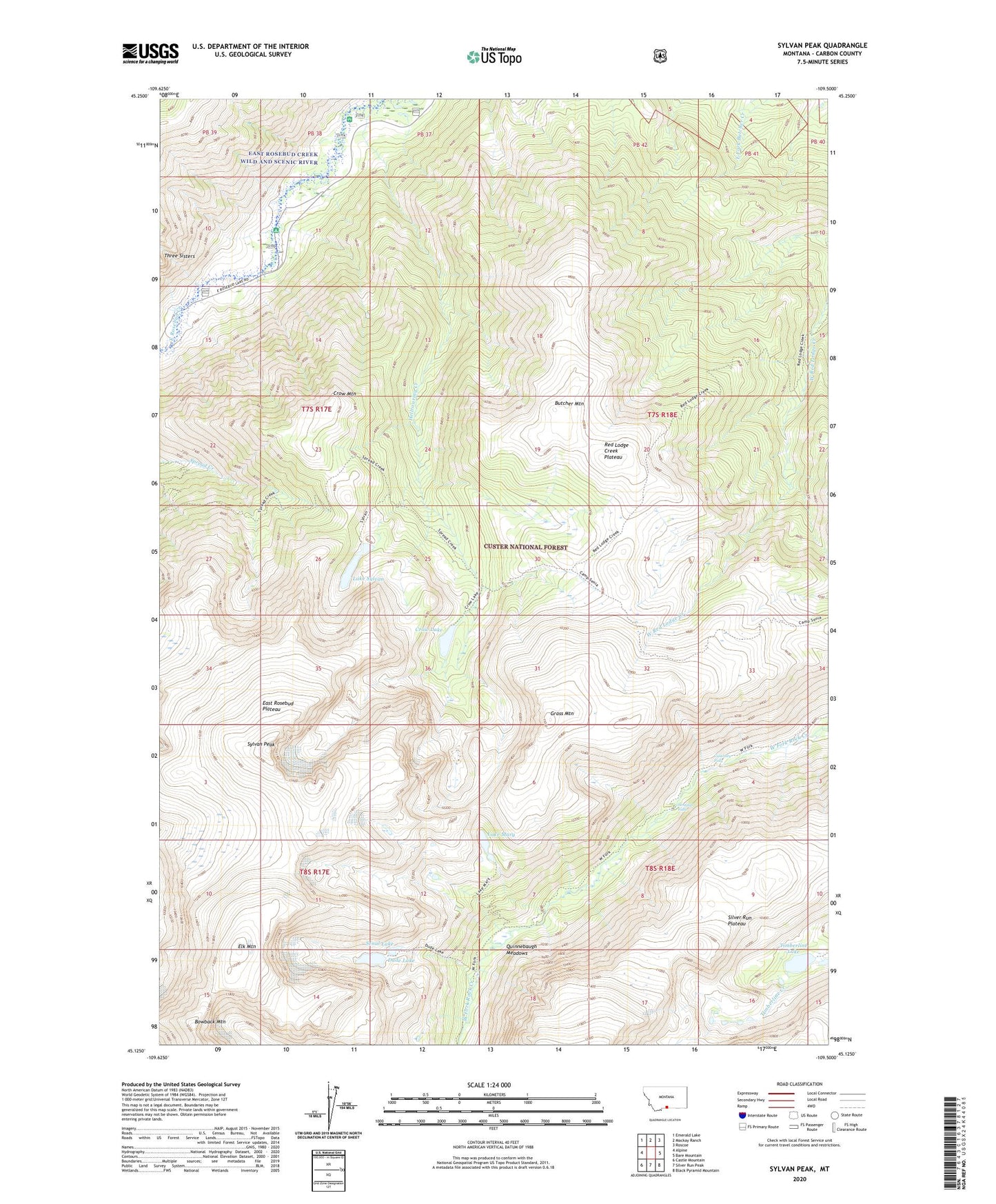
Sylvan Peak Montana US Topo Map
Couldn't load pickup availability
Also explore the Sylvan Peak Forest Service Topo of this same quad for updated USFS data
2024 topographic map quadrangle Sylvan Peak in the state of Montana. Scale: 1:24000. Based on the newly updated USGS 7.5' US Topo map series, this map is in the following counties: Carbon. The map contains contour data, water features, and other items you are used to seeing on USGS maps, but also has updated roads and other features. This is the next generation of topographic maps. Printed on high-quality waterproof paper with UV fade-resistant inks.
Quads adjacent to this one:
West: Alpine
Northwest: Emerald Lake
North: Mackay Ranch
Northeast: Roscoe
East: Bare Mountain
Southeast: Black Pyramid Mountain
South: Silver Run Peak
Southwest: Castle Mountain
This map covers the same area as the classic USGS quad with code o45109b5.
Contains the following named places: Bowback Mountain, Butcher Mountain, Calamity Falls, Crow Lake, Crow Mountain, Dude Lake, East Rosebud Plateau, Elk Mountain, Grass Mountain, Hellroaring Creek, Jimmy Joe Campground, Jimmy Joe Recreation Site, Lake Mary, Lake Sylvan, Quinnebaugh Meadows, Red Lodge Creek Plateau, Sand Dune Recreation Site, Senal Lake, Sentinel Falls, Sylvan Peak, Timberline Lake