MyTopo
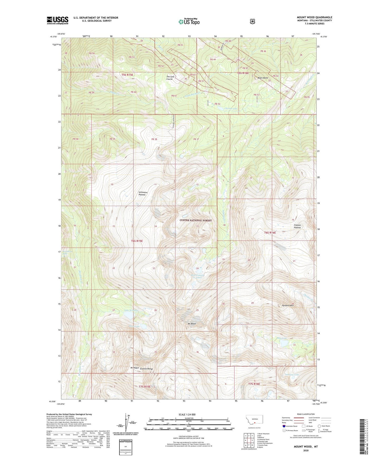
Mount Wood Montana US Topo Map
Couldn't load pickup availability
Also explore the Mount Wood Forest Service Topo of this same quad for updated USFS data
2024 topographic map quadrangle Mount Wood in the state of Montana. Scale: 1:24000. Based on the newly updated USGS 7.5' US Topo map series, this map is in the following counties: Stillwater. The map contains contour data, water features, and other items you are used to seeing on USGS maps, but also has updated roads and other features. This is the next generation of topographic maps. Printed on high-quality waterproof paper with UV fade-resistant inks.
Quads adjacent to this one:
West: Cathedral Point
Northwest: Meyer Mountain
North: Nye
Northeast: Beehive
East: Emerald Lake
Southeast: Alpine
South: Granite Peak
Southwest: Little Park Mountain
This map covers the same area as the classic USGS quad with code o45109c7.
Contains the following named places: Benbow Mine, Black Butte, Chrome Lake, Granite Range, Jawbone Lake, Lake Wildness, Mount Hague, Mount Wood, Pyramid Mountain, Ram Lake, Stillwater Plateau, The Golf Course, West Fishtail Creek Lakes, Wood Lake