
MyTopo
Beaupre Coulee Montana US Topo Map
Couldn't load pickup availability
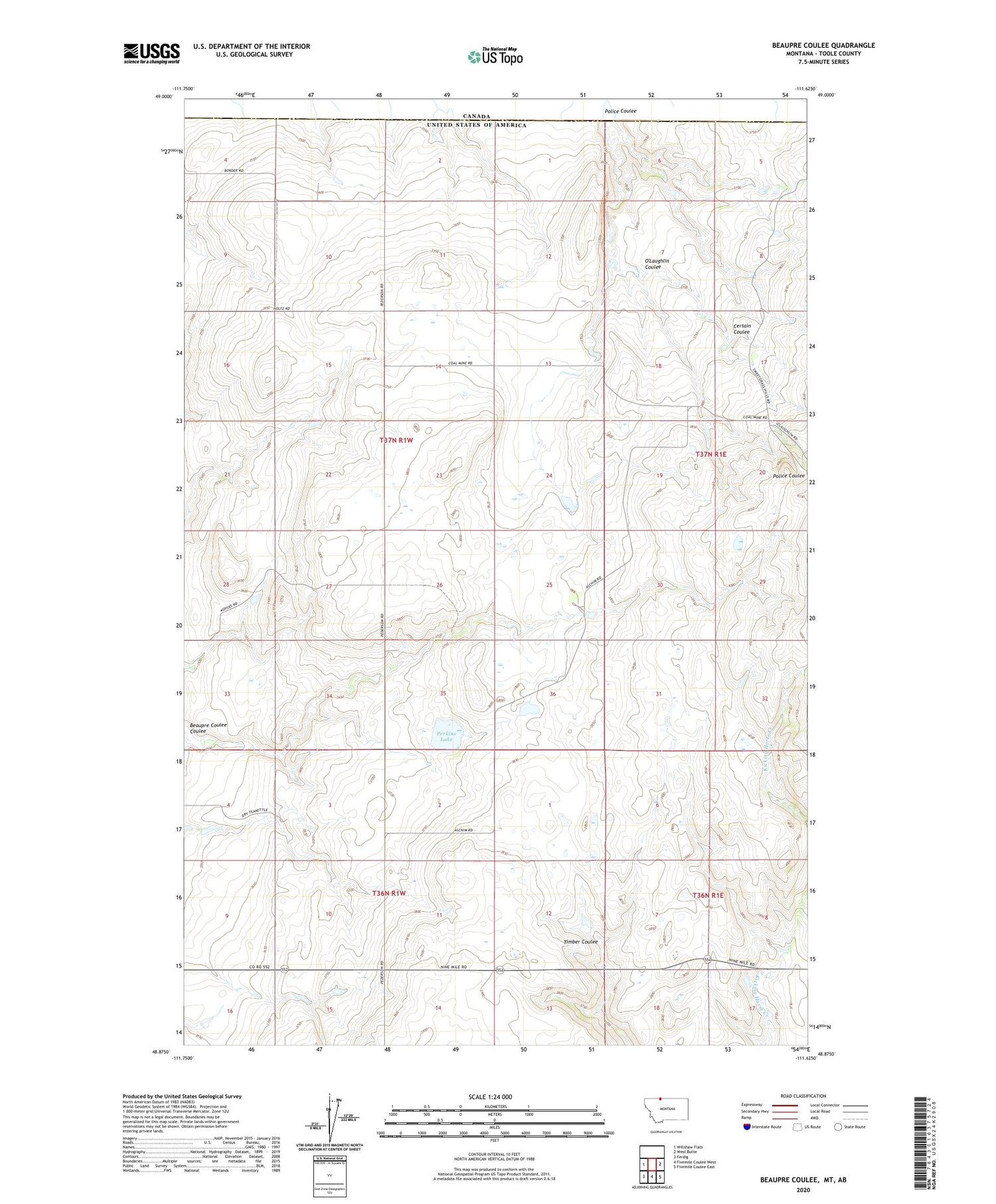
2020 topographic map quadrangle Beaupre Coulee in the state of Montana. Scale: 1:24000. Based on the newly updated USGS 7.5' US Topo map series, this map is in the following counties: Toole. The map contains contour data, water features, and other items you are used to seeing on USGS maps, but also has updated roads and other features. This is the next generation of topographic maps. Printed on high-quality waterproof paper with UV fade-resistant inks.
Quads adjacent to this one:
West: Willshaw Flats
East: West Butte
Southeast: Fivemile Coulee East
South: Fivemile Coulee West
Southwest: Ferdig
Contains the following named places: Bow and Arrow Ranch, Certain Coulee, Clark Ranch, Ha-Choo Dam, Iverson Dam, Kicking Horse Creek, Kimmett - Kleinert Dam, O'Haire Dam, O'Laughlin Coulee, O'Loughlin School, Perkins Lake, Police Coulee, Reverse B Bar X Ranch, Sweetgrass Hills Ranch, Wansley School, ZIP Code: 59484


