MyTopo
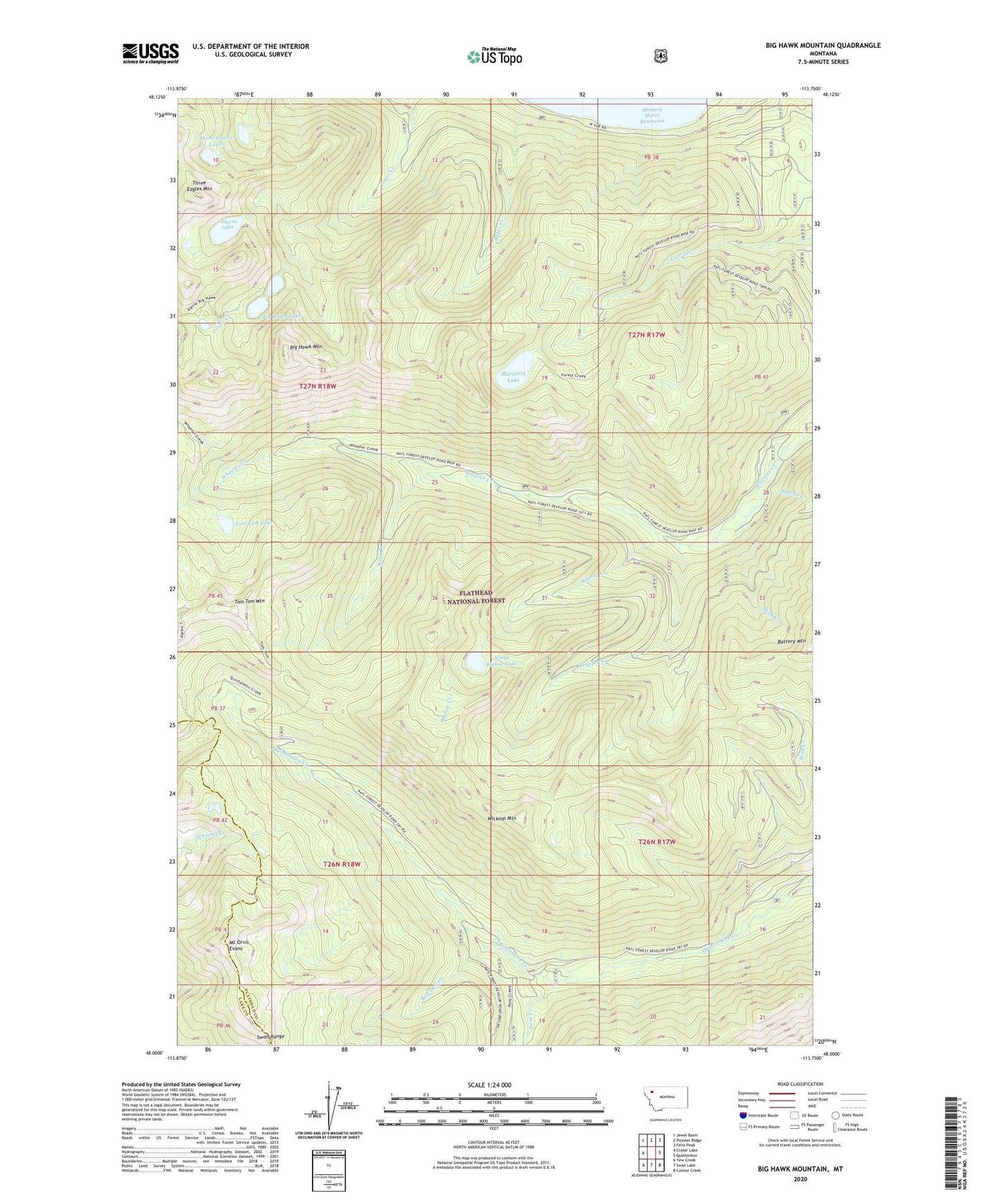
Big Hawk Mountain Montana US Topo Map
Couldn't load pickup availability
Also explore the Big Hawk Mountain Forest Service Topo of this same quad for updated USFS data
2024 topographic map quadrangle Big Hawk Mountain in the state of Montana. Scale: 1:24000. Based on the newly updated USGS 7.5' US Topo map series, this map is in the following counties: Flathead, Lake. The map contains contour data, water features, and other items you are used to seeing on USGS maps, but also has updated roads and other features. This is the next generation of topographic maps. Printed on high-quality waterproof paper with UV fade-resistant inks.
Quads adjacent to this one:
West: Crater Lake
Northwest: Jewel Basin
North: Pioneer Ridge
Northeast: Felix Peak
East: Quintonkon
Southeast: Connor Creek
South: Swan Lake
Southwest: Yew Creek
This map covers the same area as the classic USGS quad with code o48113a7.
Contains the following named places: Baker Creek, Big Hawk Lake, Big Hawk Mountain, Biglow Creek, Flathead National Forest, Graves Bay, Kate Creek, Margaret Lake, Martin Creek, Mink Creek, Mount Orvis Evans, North Biglow Lake, Pilgrim Lakes, Posy Creek, Red Owl Creek, Three Eagles Lakes, Three Eagles Mountain, Tom Tom Lake, Tom Tom Mountain, Trapper Creek, Wickiup Mountain