MyTopo
Black John Coulee Montana US Topo Map
Couldn't load pickup availability
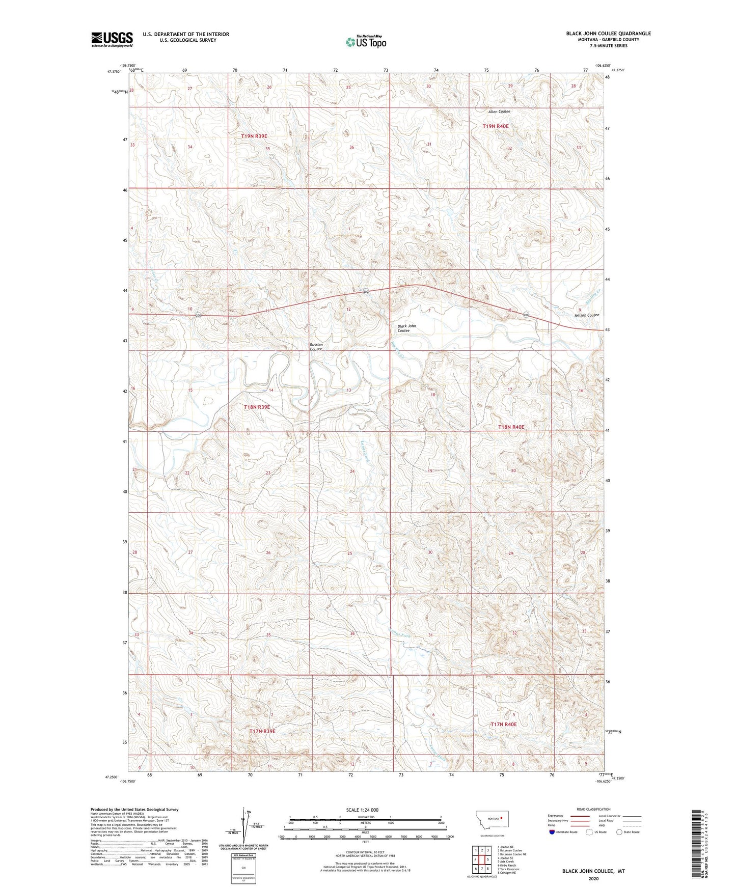
2020 topographic map quadrangle Black John Coulee in the state of Montana. Scale: 1:24000. Based on the newly updated USGS 7.5' US Topo map series, this map is in the following counties: Garfield. The map contains contour data, water features, and other items you are used to seeing on USGS maps, but also has updated roads and other features. This is the next generation of topographic maps. Printed on high-quality waterproof paper with UV fade-resistant inks.
Quads adjacent to this one:
West: Jordan SE
Northwest: Jordan NE
North: Bateman Coulee
Northeast: Bateman Coulee NE
East: Ada Creek
Southeast: Cohagen NE
South: York Reservoir
Southwest: Kirby Ranch
Contains the following named places: 18N39E13ADCD01 Well, 18N39E15C___01 Well, 18N40E08D___01 Well, Big Bucks Number 10 Dam, Black John Coulee, Harbaugh Number 1 Dam, Jones Creek, Langs Fork, Nelson Coulee, Russian Coulee