MyTopo
Ada Creek Montana US Topo Map
Couldn't load pickup availability
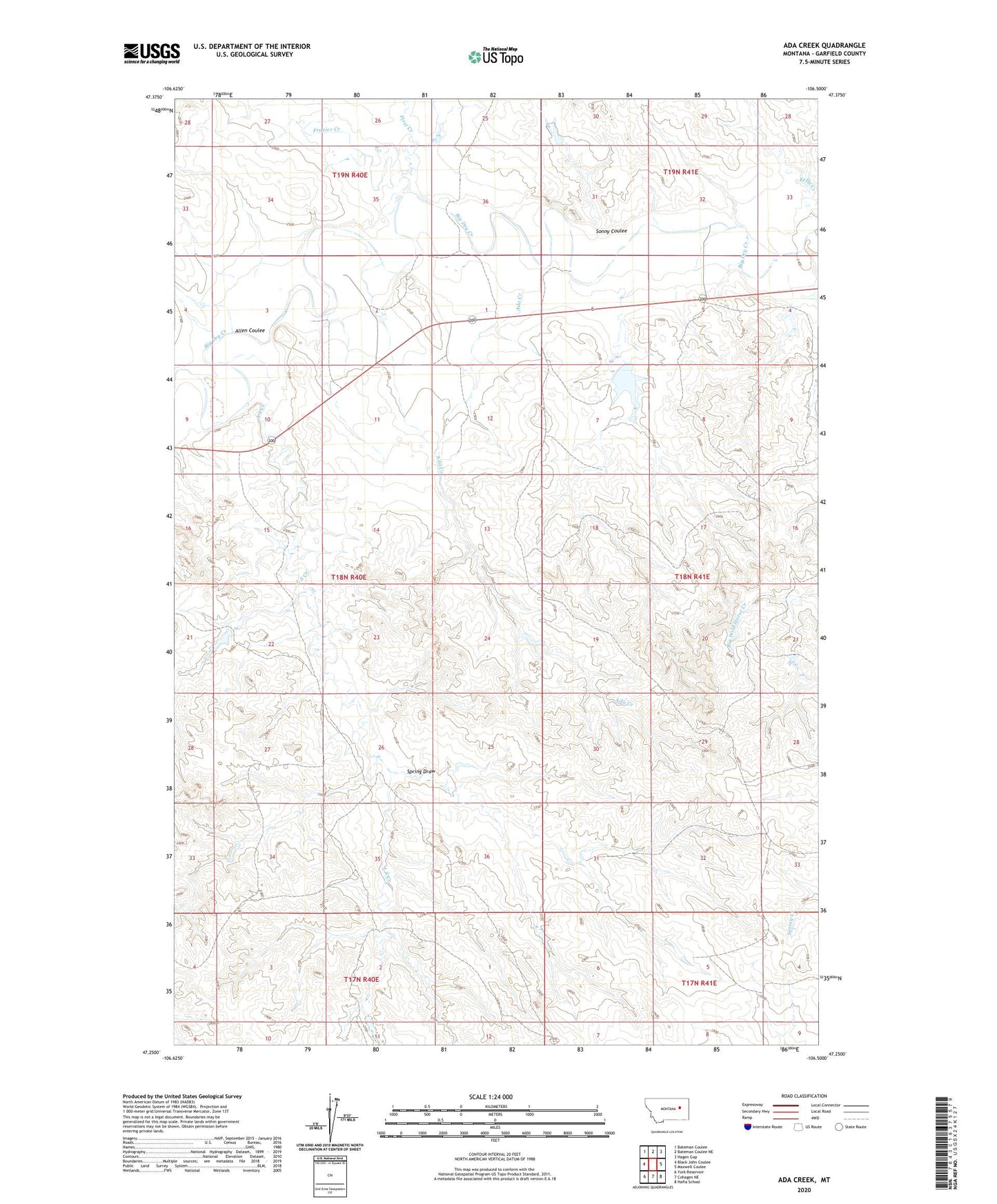
2024 topographic map quadrangle Ada Creek in the state of Montana. Scale: 1:24000. Based on the newly updated USGS 7.5' US Topo map series, this map is in the following counties: Garfield. The map contains contour data, water features, and other items you are used to seeing on USGS maps, but also has updated roads and other features. This is the next generation of topographic maps. Printed on high-quality waterproof paper with UV fade-resistant inks.
Quads adjacent to this one:
West: Black John Coulee
Northwest: Bateman Coulee
North: Bateman Coulee NE
Northeast: Hagen Gap
East: Maxwell Coulee
Southeast: Hafla School
South: Cohagen NE
Southwest: York Reservoir
This map covers the same area as the classic USGS quad with code o47106c5.
Contains the following named places: 17N41E06A___01 Well, 18N40E01B___01 Well, 18N40E01C___01 Well, 18N40E01C___02 Well, 18N40E01DBBB01 Well, 18N40E02B___01 Well, 18N41E29D___01 Well, 18N41E33C___01 Well, 19N41E31C___01 Well, 19N41E32C___01 Well, Ada Creek, Allen Coulee, Dry Lake Dam, First Creek, Frazier Creek, Jim J Murion Number 1 Dam, Jim J Murion Number 2 Dam, Karen Number 2 Dam, Karen Number 3 Dam, Kelly Creek, Keplerville, Keplerville Post Office, Keplerville School, L S Creek, Mahoney Ranch, Murnions Dam, Murnions Reservoir, Sonny Coulee, Sonny Number 1 Dam, Spring Draw, Viall School, Yellow Horse Dam