MyTopo
Bateman Coulee Montana US Topo Map
Couldn't load pickup availability
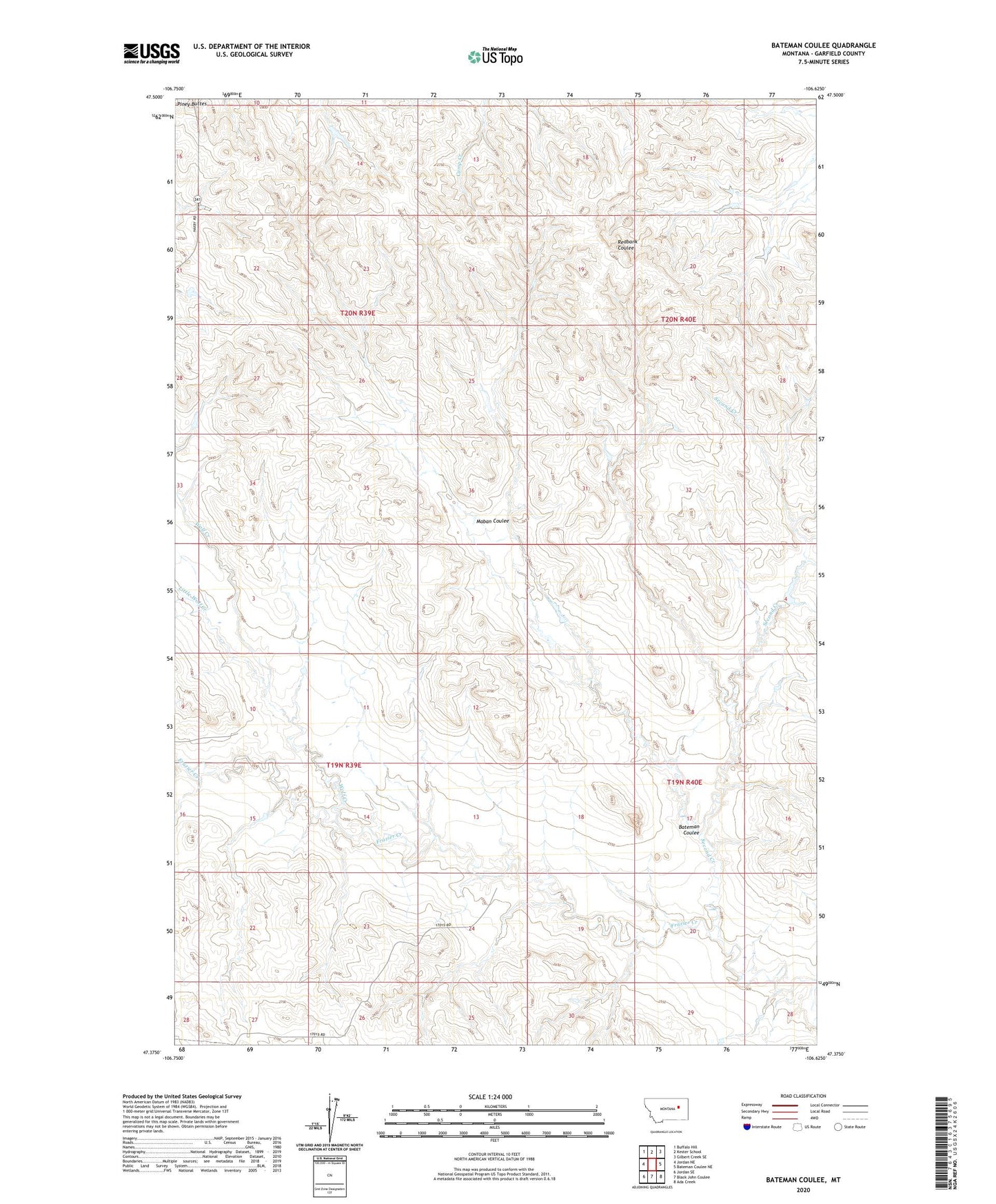
2024 topographic map quadrangle Bateman Coulee in the state of Montana. Scale: 1:24000. Based on the newly updated USGS 7.5' US Topo map series, this map is in the following counties: Garfield. The map contains contour data, water features, and other items you are used to seeing on USGS maps, but also has updated roads and other features. This is the next generation of topographic maps. Printed on high-quality waterproof paper with UV fade-resistant inks.
Quads adjacent to this one:
West: Jordan NE
Northwest: Buffalo Hill
North: Kester School
Northeast: Gilbert Creek SE
East: Bateman Coulee NE
Southeast: Ada Creek
South: Black John Coulee
Southwest: Jordan SE
This map covers the same area as the classic USGS quad with code o47106d6.
Contains the following named places: 19N39E03C___01 Well, 19N39E12A___01 Well, 19N39E24A___01 Well, 19N40E19B___01 Well, 19N40E21C___01 Well, 20N39E22CBCD01 Well, 20N40E16D___01 Well, 20N40E28A___01 Well, 20N40E32B___01 Well, Bateman Coulee, Bateman Number 1 Dam, Big Bucks Number 5 Dam, Little Wolf Creek, Maban Coulee, Second Creek, Wolf Creek