MyTopo
Blackleaf Montana US Topo Map
Couldn't load pickup availability
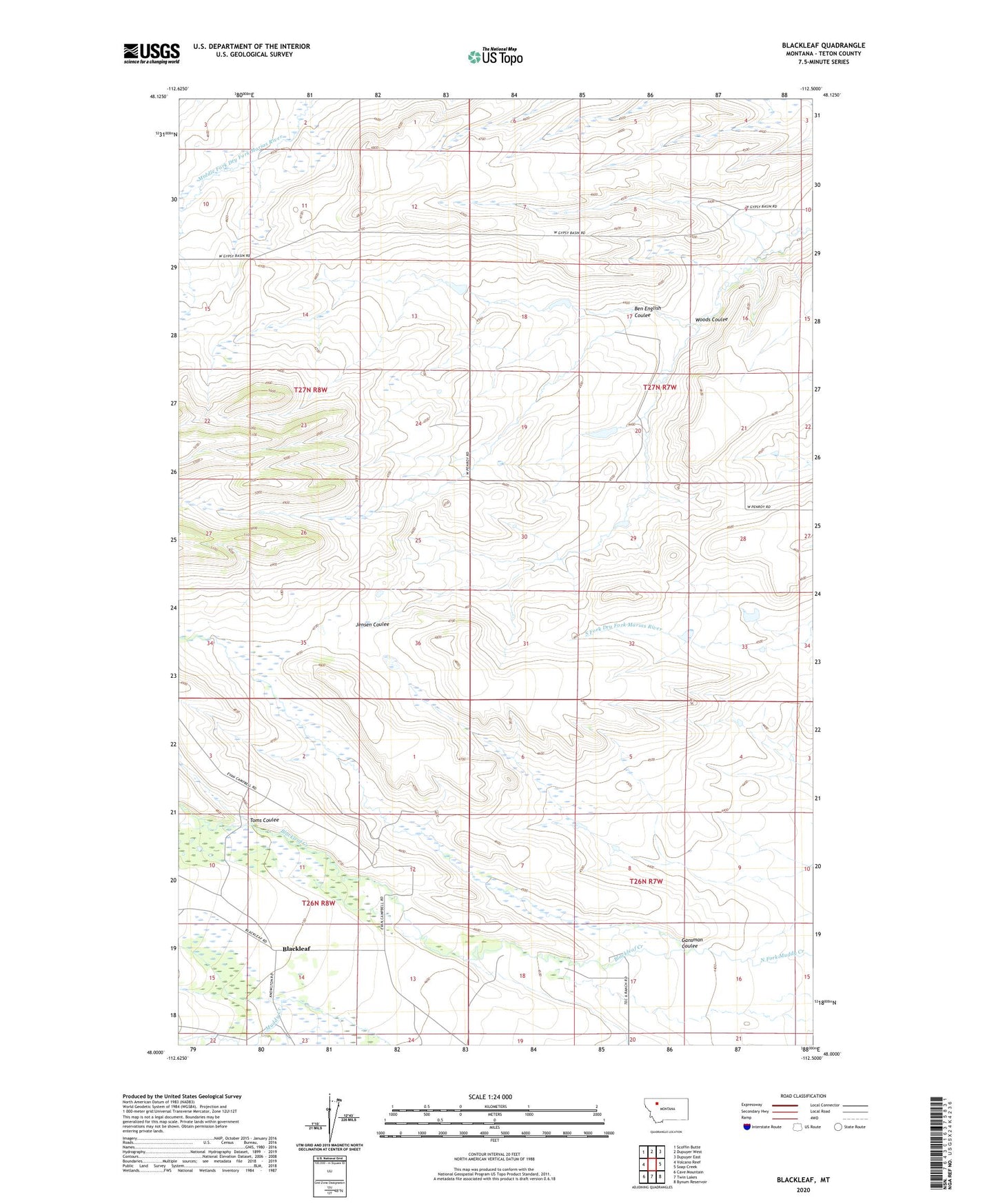
2020 topographic map quadrangle Blackleaf in the state of Montana. Scale: 1:24000. Based on the newly updated USGS 7.5' US Topo map series, this map is in the following counties: Teton. The map contains contour data, water features, and other items you are used to seeing on USGS maps, but also has updated roads and other features. This is the next generation of topographic maps. Printed on high-quality waterproof paper with UV fade-resistant inks.
Quads adjacent to this one:
West: Volcano Reef
Northwest: Scoffin Butte
North: Dupuyer West
Northeast: Dupuyer East
East: Soap Creek
Southeast: Bynum Reservoir
South: Twin Lakes
Southwest: Cave Mountain
Contains the following named places: 27N08W13CDD_01 Well, 59467, Ben English Coulee, Blackleaf, Blackleaf Creek, Blackleaf Post Office, Decameter Dam, Decarboxylation Dam, Gansman Coulee, Rockport Colong Number 1 Dam, Rockport Colony Number 2 Dam, Toms Coulee, Woods Coulee