MyTopo
Bynum Reservoir Montana US Topo Map
Couldn't load pickup availability
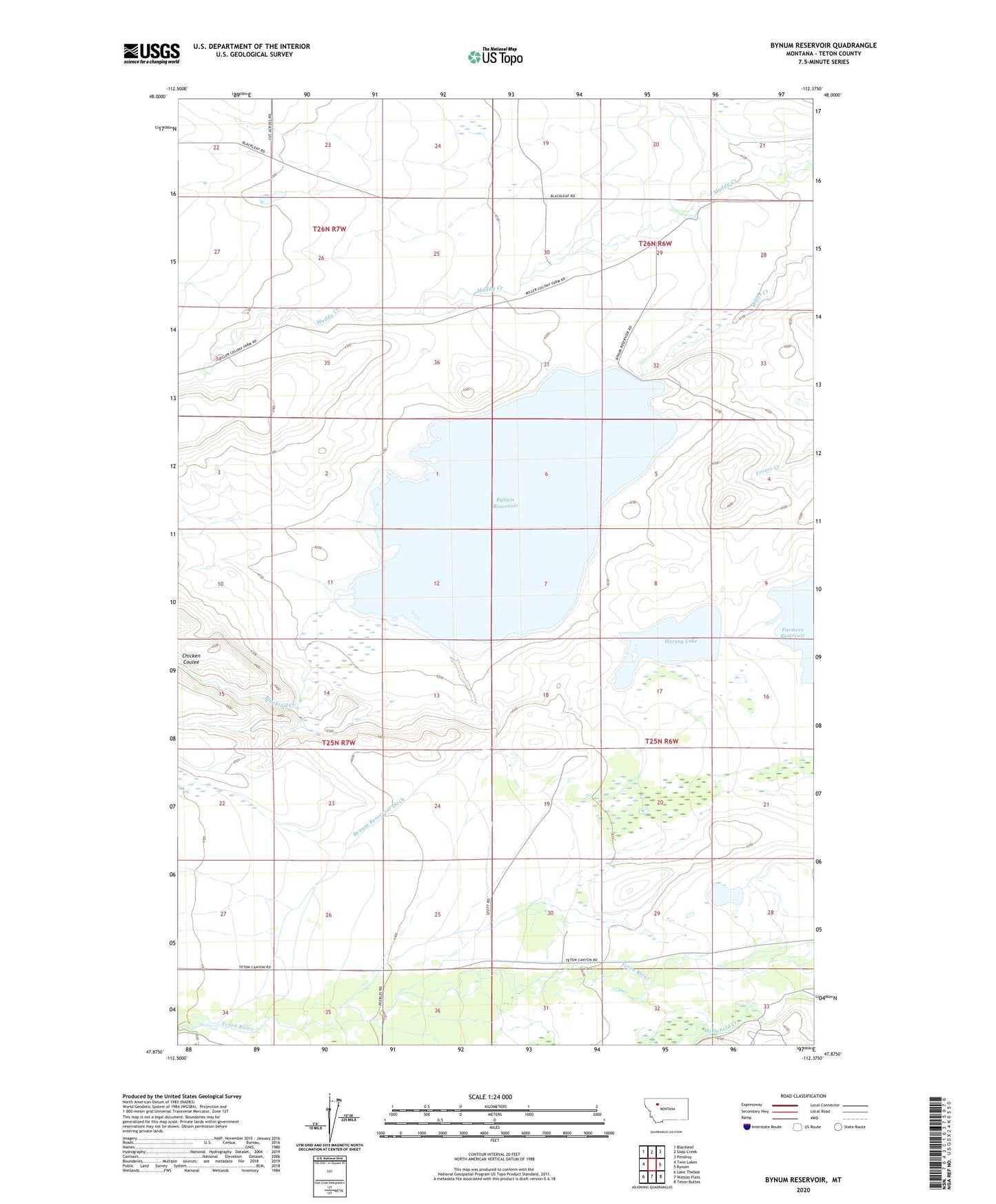
2024 topographic map quadrangle Bynum Reservoir in the state of Montana. Scale: 1:24000. Based on the newly updated USGS 7.5' US Topo map series, this map is in the following counties: Teton. The map contains contour data, water features, and other items you are used to seeing on USGS maps, but also has updated roads and other features. This is the next generation of topographic maps. Printed on high-quality waterproof paper with UV fade-resistant inks.
Quads adjacent to this one:
West: Twin Lakes
Northwest: Blackleaf
North: Soap Creek
Northeast: Pendroy
East: Bynum
Southeast: Teton Buttes
South: Watson Flats
Southwest: Lake Theboe
This map covers the same area as the classic USGS quad with code o47112h4.
Contains the following named places: 25N06W30DBD_01 Well, 59419, Blacktail Creek, Bynum Reservoir, Bynum Reservoir Ditch, Bynum Reservoir Fishing Access Site, Choteau Division, Crary Ranch, Crawford Ranch, Decuman Dam, Deminish Dam, Harvey Lake, Harvey Lake Dam, Tetonview School