MyTopo
Soap Creek Montana US Topo Map
Couldn't load pickup availability
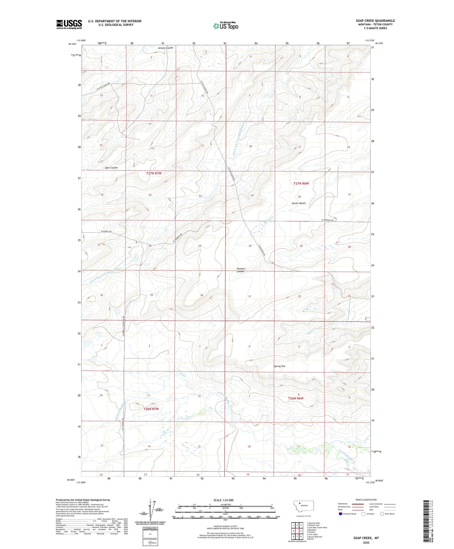
2024 topographic map quadrangle Soap Creek in the state of Montana. Scale: 1:24000. Based on the newly updated USGS 7.5' US Topo map series, this map is in the following counties: Teton. The map contains contour data, water features, and other items you are used to seeing on USGS maps, but also has updated roads and other features. This is the next generation of topographic maps. Printed on high-quality waterproof paper with UV fade-resistant inks.
Quads adjacent to this one:
West: Blackleaf
Northwest: Dupuyer West
North: Dupuyer East
Northeast: Lone Man Coulee West
East: Pendroy
Southeast: Bynum
South: Bynum Reservoir
Southwest: Twin Lakes
This map covers the same area as the classic USGS quad with code o48112a4.
Contains the following named places: Harmony School, Jensen Ranch, Rockport Colony, Rockport Colony Census Designated Place, Rockport Colony School, Soap Creek, Spring Hill, Spring Hill Ranch, Sullivan Ranch