
MyTopo
Boulder Peak Montana US Topo Map
Couldn't load pickup availability
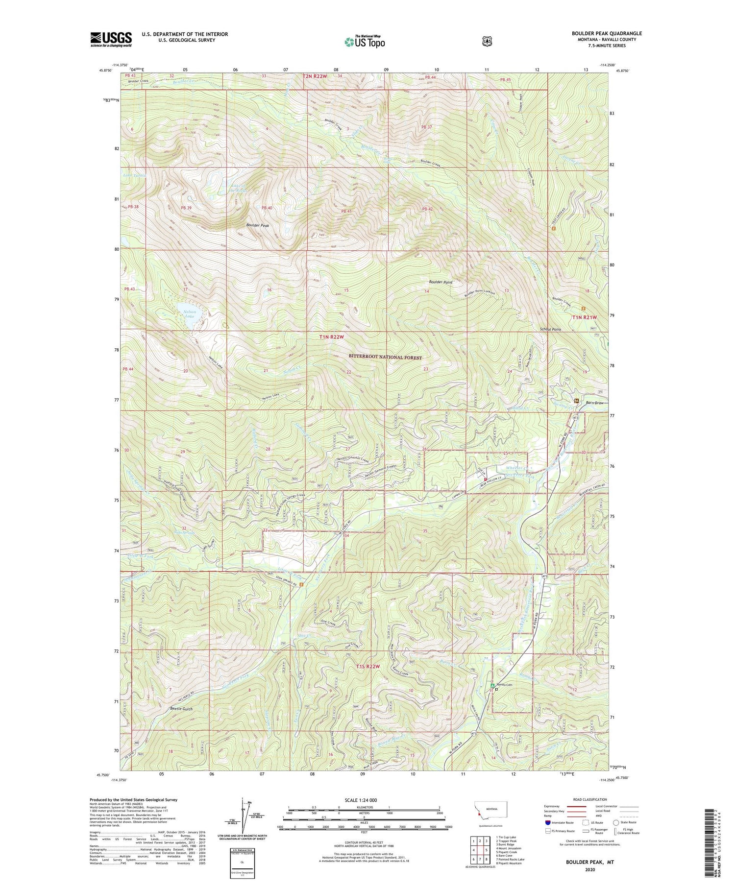
2020 topographic map quadrangle Boulder Peak in the state of Montana. Scale: 1:24000. Based on the newly updated USGS 7.5' US Topo map series, this map is in the following counties: Ravalli. The map contains contour data, water features, and other items you are used to seeing on USGS maps, but also has updated roads and other features. This is the next generation of topographic maps. Printed on high-quality waterproof paper with UV fade-resistant inks.
Quads adjacent to this one:
West: Mount Jerusalem
Northwest: Tin Cup Lake
North: Trapper Peak
Northeast: Burnt Ridge
East: Piquett Creek
Southeast: Piquett Mountain
South: Painted Rocks Lake
Southwest: Bare Cone
Contains the following named places: Barn Draw, Basin Creek, Beavertail Creek, Beetle Gulch, Bonnie Blue Creek, Boulder Falls, Boulder Peak, Boulder Point, Brickley Stage Stop, Buck Creek, Crow Creek, Ditch Creek, Gemmell Creek, Halford Creek, Krueger Ranch, Lake of the Rocks, Little West Fork, Little West Fork Campground, Mink Creek, Nelson Creek, Nelson Lake, Nez Perce Fork, Old Nez Perce Indian Trail, One Creek, Rombo Cemetery, Rombo Creek, Rombo Creek Campground, School Point, Sentimental Creek, Slide Creek, Soda Springs, Soda Springs Creek, Surprise Creek, Swamp Creek, Trapper Peak Trail, Two Creek, Ward Creek, West Fork Ranger Station, West Fork Volunteer Fire Department Station 2, Wheeler Creek, ZIP Code: 59829


