MyTopo
Tin Cup Lake Montana US Topo Map
Couldn't load pickup availability
Also explore the Tin Cup Lake Forest Service Topo of this same quad for updated USFS data
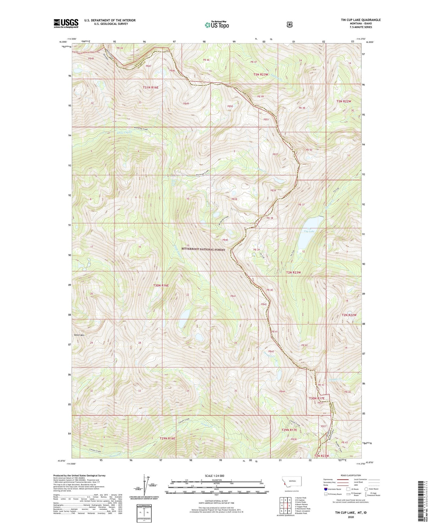
2024 topographic map quadrangle Tin Cup Lake in the states of Idaho, Montana. Scale: 1:24000. Based on the newly updated USGS 7.5' US Topo map series, this map is in the following counties: Ravalli, Idaho. The map contains contour data, water features, and other items you are used to seeing on USGS maps, but also has updated roads and other features. This is the next generation of topographic maps. Printed on high-quality waterproof paper with UV fade-resistant inks.
Quads adjacent to this one:
West: Mount Paloma
Northwest: Hunter Peak
North: El Capitan
Northeast: Como Peaks
East: Trapper Peak
Southeast: Boulder Peak
South: Mount Jerusalem
Southwest: Watchtower Peak
This map covers the same area as the classic USGS quad with code o45114h4.
Contains the following named places: Patsy Ann Falls, Tin Cup Lake, Tin Cup Lake Dam, Triple Creek, Triple Lakes, Vance Mountain, White Cap Lakes