MyTopo
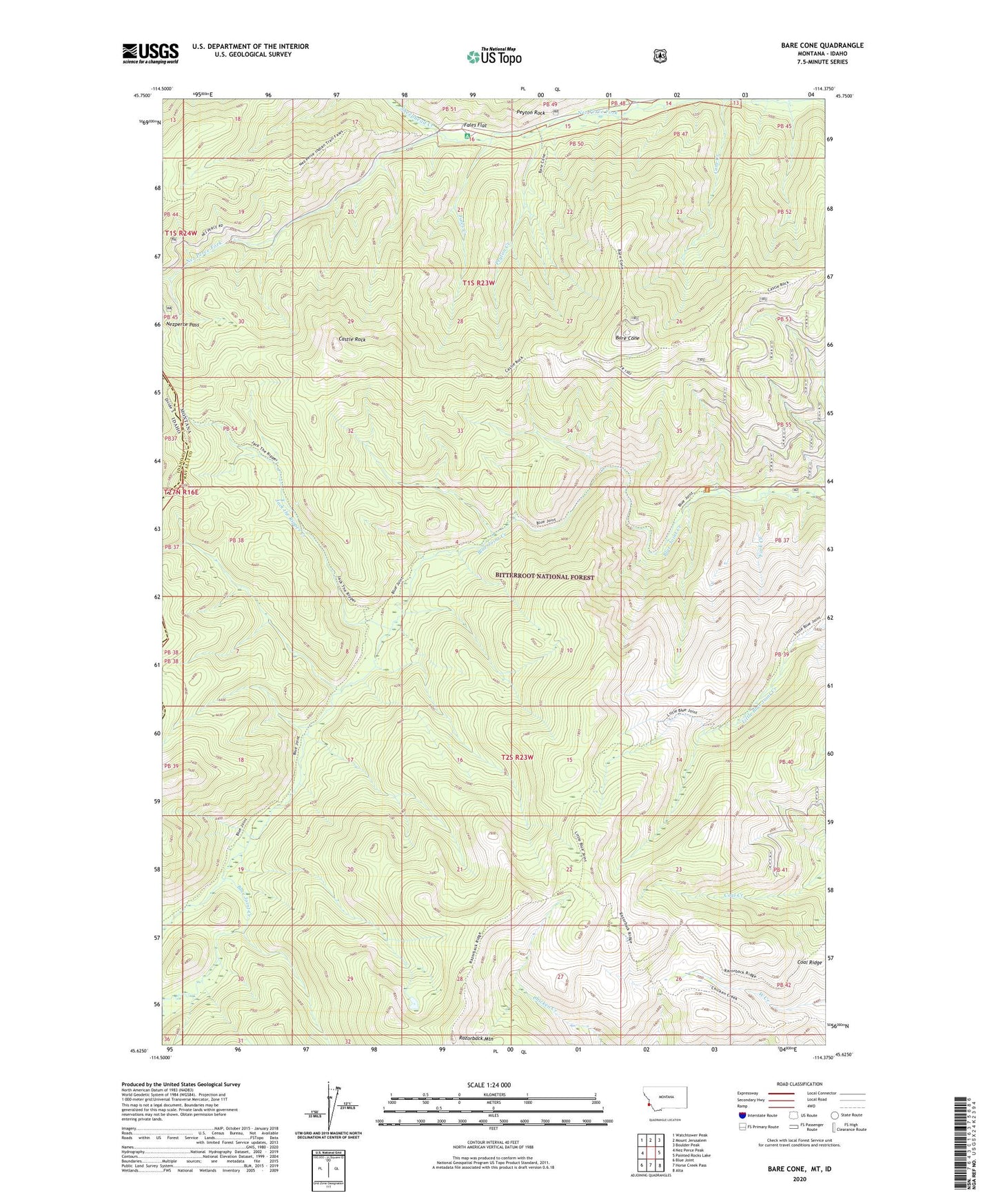
Bare Cone Montana US Topo Map
Couldn't load pickup availability
Also explore the Bare Cone Forest Service Topo of this same quad for updated USFS data
2024 topographic map quadrangle Bare Cone in the state of Montana. Scale: 1:24000. Based on the newly updated USGS 7.5' US Topo map series, this map is in the following counties: Ravalli, Idaho. The map contains contour data, water features, and other items you are used to seeing on USGS maps, but also has updated roads and other features. This is the next generation of topographic maps. Printed on high-quality waterproof paper with UV fade-resistant inks.
Quads adjacent to this one:
West: Nez Perce Peak
Northwest: Watchtower Peak
North: Mount Jerusalem
Northeast: Boulder Peak
East: Painted Rocks Lake
Southeast: Alta
South: Horse Creek Pass
Southwest: Blue Joint
This map covers the same area as the classic USGS quad with code o45114f4.
Contains the following named places: Bare Cone, Castle Rock, Castle Rock Trail, Charlies Waterhole, Coal Ridge, Cone Creek, Fales Creek, Fales Flat, Fales Flat Group Campsite, Flat Creek, Fork Creek, Jack the Ripper Creek, Nez Perce Camp, Nezperce Pass, North Route of Old Nez Perce Trail, Peyton Creek, Peyton Rock, Razorback Mountain, Sheephead Creek, South Route of Old Nez Perce Trail, Watchtower Creek