MyTopo
Broadview West Montana US Topo Map
Couldn't load pickup availability
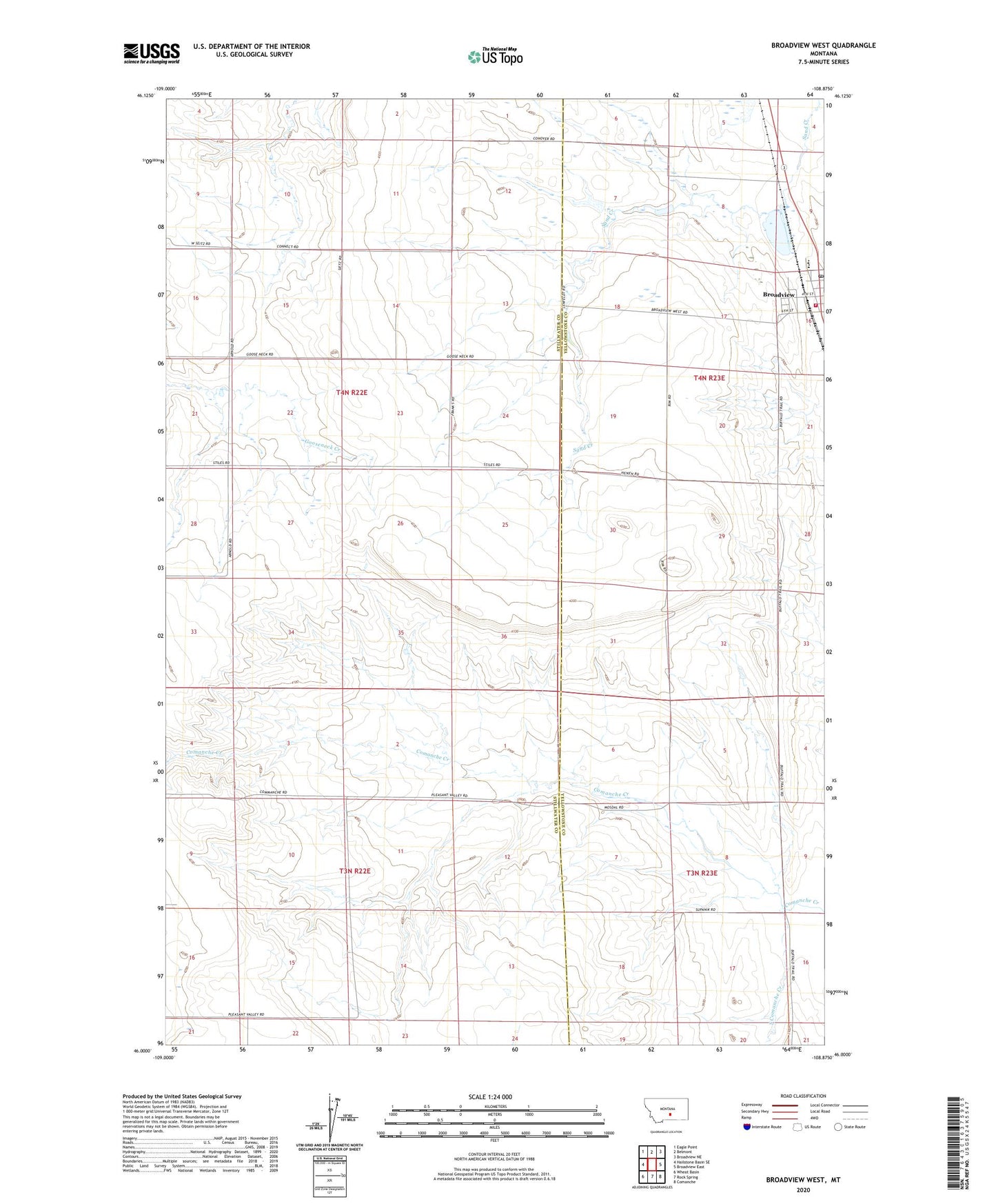
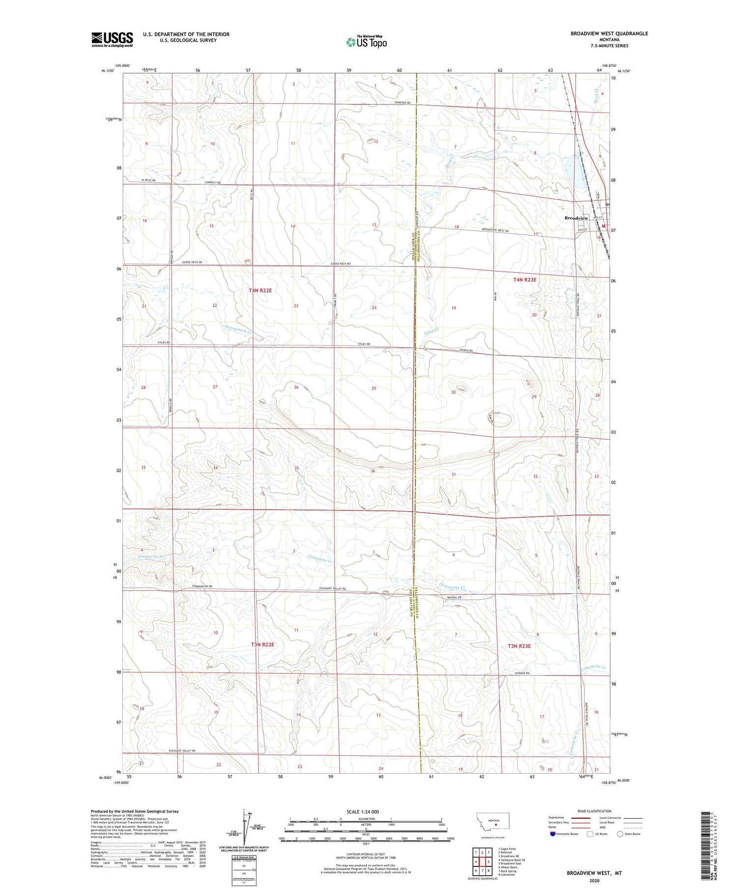
2020 topographic map quadrangle Broadview West in the state of Montana. Scale: 1:24000. Based on the newly updated USGS 7.5' US Topo map series, this map is in the following counties: Stillwater, Yellowstone. The map contains contour data, water features, and other items you are used to seeing on USGS maps, but also has updated roads and other features. This is the next generation of topographic maps. Printed on high-quality waterproof paper with UV fade-resistant inks.
Quads adjacent to this one:
West: Hailstone Basin SE
Northwest: Eagle Point
North: Belmont
Northeast: Broadview NE
East: Broadview East
Southeast: Comanche
South: Rock Spring
Southwest: Wheat Basin
Contains the following named places: 03N23E04C___01 Well, 03N23E17A___01 Well, 04N22E14ACCB01 Well, 04N23E16BCCC01 Well, 04N47E31CBCA01 Well, Broadview, Broadview Pond, Broadview Pond Fishing Access Site, Broadview Post Office, Broadview Volunteer Fire Department, Conover Number 2 Dam, Nowhere Dam, South Comanche Creek, Town of Broadview