MyTopo
Eagle Point Montana US Topo Map
Couldn't load pickup availability
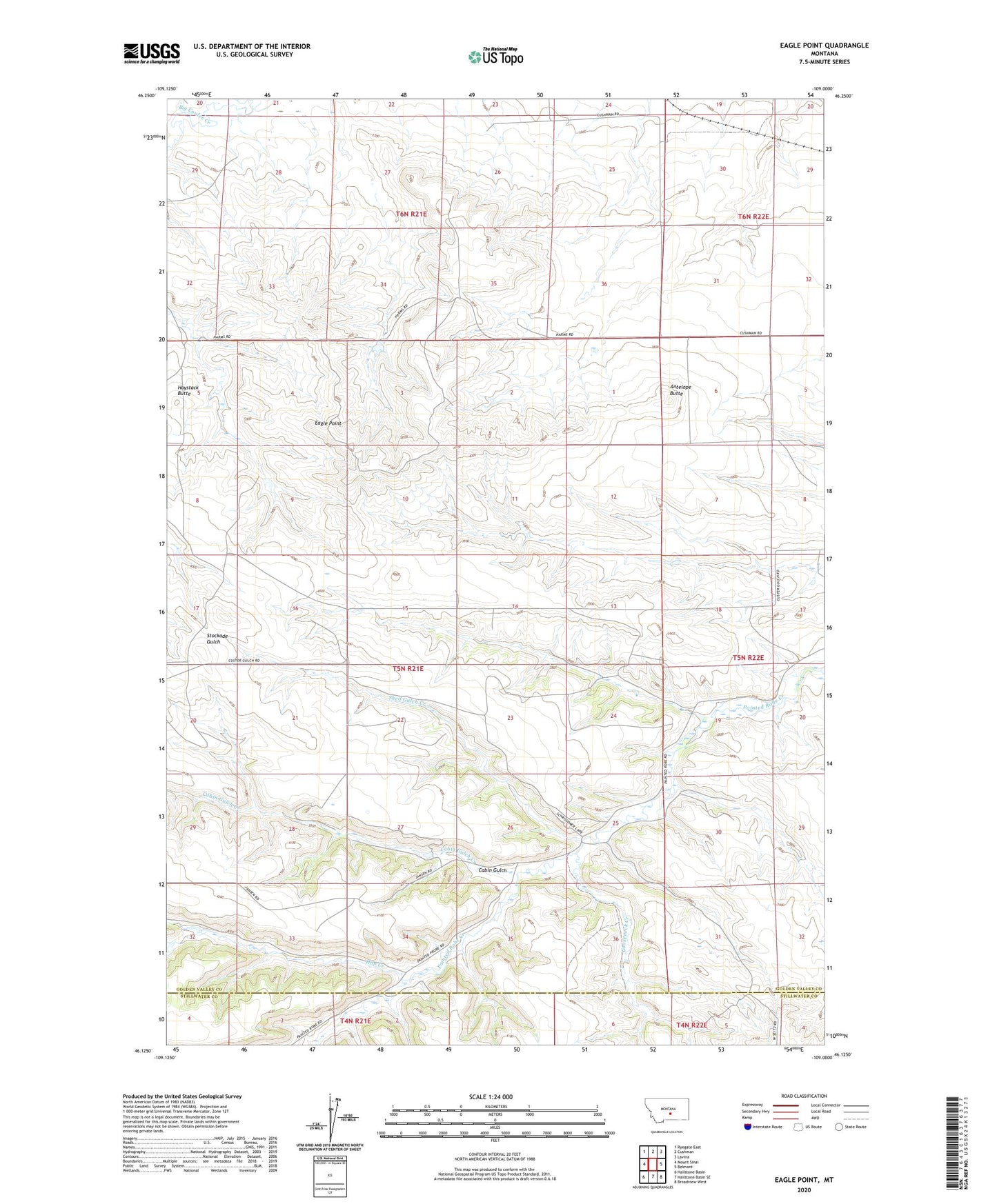
2024 topographic map quadrangle Eagle Point in the state of Montana. Scale: 1:24000. Based on the newly updated USGS 7.5' US Topo map series, this map is in the following counties: Golden Valley, Stillwater. The map contains contour data, water features, and other items you are used to seeing on USGS maps, but also has updated roads and other features. This is the next generation of topographic maps. Printed on high-quality waterproof paper with UV fade-resistant inks.
Quads adjacent to this one:
West: Mount Sinai
Northwest: Ryegate East
North: Cushman
Northeast: Lavina
East: Belmont
Southeast: Broadview West
South: Hailstone Basin SE
Southwest: Hailstone Basin
This map covers the same area as the classic USGS quad with code o46109b1.
Contains the following named places: Antelope Butte, Cabin Gulch, Cabin Gulch Creek, Eagle Point, Gooseneck Creek, Haystack Butte, Hop Creek, Shed Gulch Creek