MyTopo
Brockway Spring Montana US Topo Map
Couldn't load pickup availability
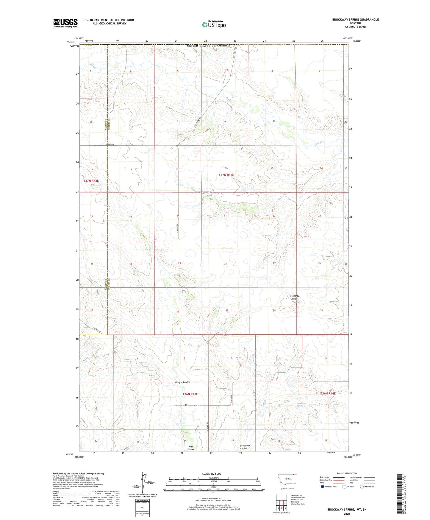
2020 topographic map quadrangle Brockway Spring in the state of Montana. Scale: 1:24000. Based on the newly updated USGS 7.5' US Topo map series, this map is in the following counties: Daniels, Valley. The map contains contour data, water features, and other items you are used to seeing on USGS maps, but also has updated roads and other features. This is the next generation of topographic maps. Printed on high-quality waterproof paper with UV fade-resistant inks.
Quads adjacent to this one:
West: Kaminski Hill
East: Flaherty Coulee
Southeast: Horseshoe Basin
South: Richland
Southwest: Glentana East
Contains the following named places: 36N43E01DABC01 Well, 36N43E01DBDD01 Well, 36N43E04BCCA01 Well, 36N43E04BCCD01 Well, 36N43E10AAAA01 Well, 36N43E11BBDB01 Well, 37N42E36AACA01 Well, 37N43E04BDDC01 Well, 37N43E04CAAA01 Well, 37N43E06BAAB01 Well, 37N43E06BAAB02 Well, 37N43E17DCAC01 Well, 37N43E17DCAC02 Well, 37N43E32CACA01 Well, 37N43E33CDBD01 Well, Bjarne Number 1 Dam, Bjarne Number 2 Dam, Brockway Spring, Morgan Coulee, Stub Dam