MyTopo
Glentana East Montana US Topo Map
Couldn't load pickup availability
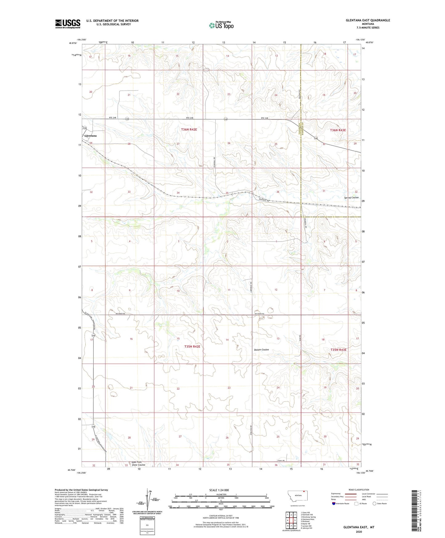
2024 topographic map quadrangle Glentana East in the state of Montana. Scale: 1:24000. Based on the newly updated USGS 7.5' US Topo map series, this map is in the following counties: Valley, Daniels. The map contains contour data, water features, and other items you are used to seeing on USGS maps, but also has updated roads and other features. This is the next generation of topographic maps. Printed on high-quality waterproof paper with UV fade-resistant inks.
Quads adjacent to this one:
West: Glentana West
Northwest: Glass Hill
North: Kaminski Hill
Northeast: Brockway Spring
East: Richland
Southeast: Johnnys Hill
South: Larslan NW
Southwest: Baylor NE
This map covers the same area as the classic USGS quad with code o48106g2.
Contains the following named places: 37N42E13BCCA01 Well, 59240, Fairview School, Glentana, Glentana Post Office, Glentana School, Holy Family Catholic Church, Lost Sunflower School