MyTopo
Flaherty Coulee Montana US Topo Map
Couldn't load pickup availability
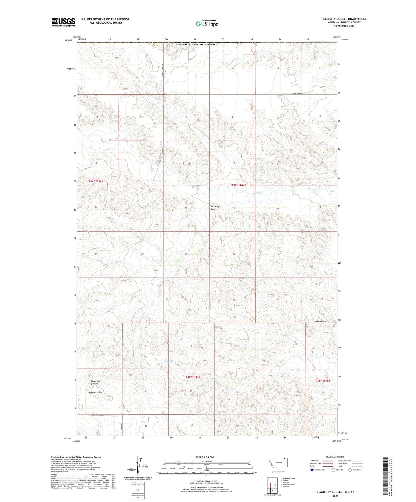
2024 topographic map quadrangle Flaherty Coulee in the state of Montana. Scale: 1:24000. Based on the newly updated USGS 7.5' US Topo map series, this map is in the following counties: Daniels. The map contains contour data, water features, and other items you are used to seeing on USGS maps, but also has updated roads and other features. This is the next generation of topographic maps. Printed on high-quality waterproof paper with UV fade-resistant inks.
Quads adjacent to this one:
West: Brockway Spring
East: Carbert
Southeast: Peerless
South: Horseshoe Basin
Southwest: Richland
This map covers the same area as the classic USGS quad with code o48105h8.
Contains the following named places: 36N44E16BBBD01 Well, 37N43E25DDDD01 Well, 37N44E03BCCB01 Well, 37N44E03CDCD01 Well, 37N44E04ADDD01 Well, 37N44E04ADDD02 Well, 37N44E04DCCD01 Well, 37N44E05ACCC01 Well, 37N44E05DBBB01 Well, 37N44E07AAAA01 Well, 37N44E08DBDB01 Well, 37N44E09AAAA01 Well, 37N44E32ADDA01 Well, Flaherty Coulee