MyTopo
Bullhead Reservoir Montana US Topo Map
Couldn't load pickup availability
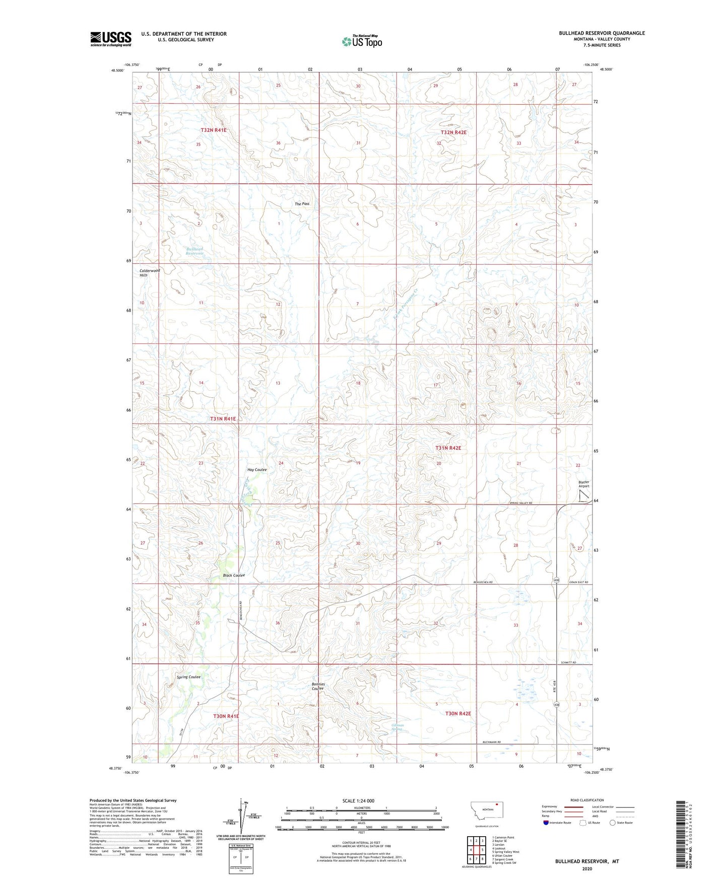
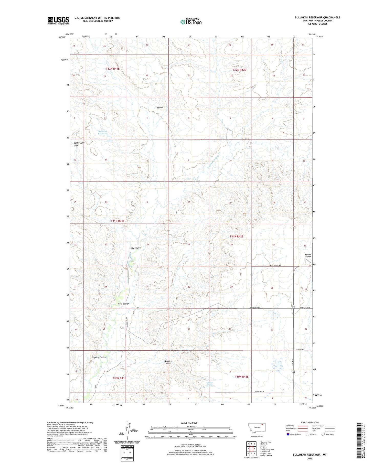
2020 topographic map quadrangle Bullhead Reservoir in the state of Montana. Scale: 1:24000. Based on the newly updated USGS 7.5' US Topo map series, this map is in the following counties: Valley. The map contains contour data, water features, and other items you are used to seeing on USGS maps, but also has updated roads and other features. This is the next generation of topographic maps. Printed on high-quality waterproof paper with UV fade-resistant inks.
Quads adjacent to this one:
West: Lookout
Northwest: Cameron Point
North: Baylor SE
Northeast: Larslan
East: Spring Valley West
Southeast: Spring Creek SW
South: Sargent Creek
Southwest: Uhlan Coulee
Contains the following named places: 30N42E04DCDA01 Well, 30N42E08BBAA01 Well, 31N42E27BABA01 Well, 31N42E28DCDD01 Well, Bethel Lutheran Church of Grain, Black Coulee, Blatter Airport, Bonnies Coulee, Bullhead Reservoir, Fort Peck Reservation Number 11 Dam, Gillman Spring, Grain School, Hay Coulee, Spring Coulee, The Pass, Three Forks