
MyTopo
Burnt Ridge Montana US Topo Map
Couldn't load pickup availability
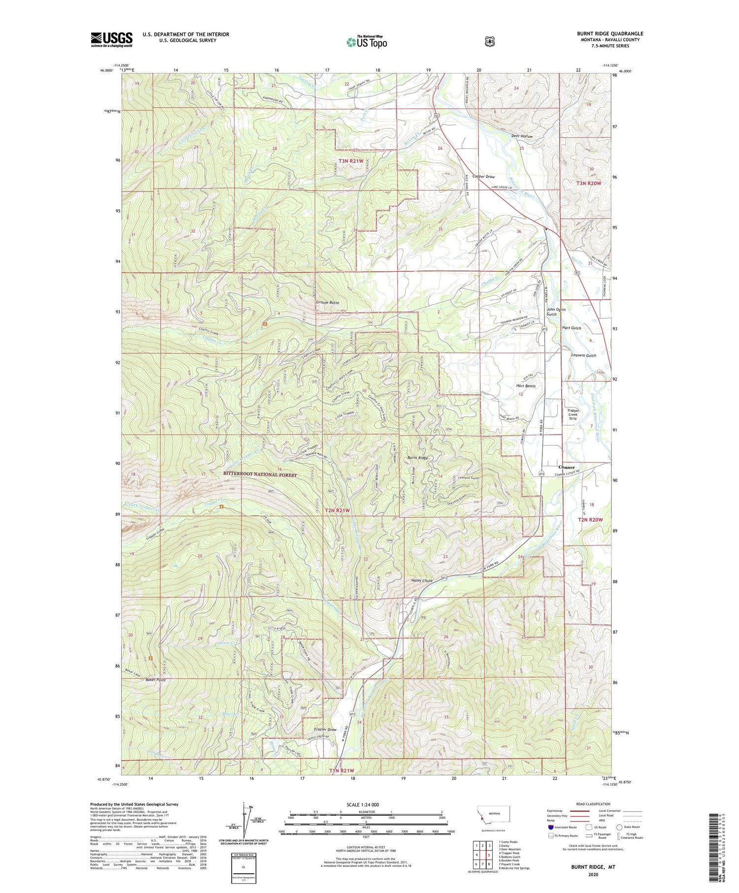
2020 topographic map quadrangle Burnt Ridge in the state of Montana. Scale: 1:24000. Based on the newly updated USGS 7.5' US Topo map series, this map is in the following counties: Ravalli. The map contains contour data, water features, and other items you are used to seeing on USGS maps, but also has updated roads and other features. This is the next generation of topographic maps. Printed on high-quality waterproof paper with UV fade-resistant inks.
Quads adjacent to this one:
West: Trapper Peak
Northwest: Como Peaks
North: Darby
Northeast: Deer Mountain
East: Robbins Gulch
Southeast: Medicine Hot Springs
South: Piquett Creek
Southwest: Boulder Peak
Contains the following named places: 02N20W07BCCC01 Well, 02N21W12CDBA01 Well, 02N21W12DCAC01 Well, 02N21W34CBD_01 Well, 02N21W34CDAC01 Well, 03N20W31DBBC01 Well, 03N20W31DBCC01 Well, 03N21W26BBB_01 Well, Baker Point, Burnt Ridge, Chaffin Creek, Comer Sawmill, Conner Census Designated Place, Cooper Draw, Darby Landfill, Deer Hollow, East Fork Bitterroot River, Frazier Draw, Grouse Butte, Haley Chute, Hannon Memorial Fishing Access Site, Hart Bench, Hart Gulch, John Ogrin Gulch, Leavens Gulch, Little Tin Cup Creek, Little Trapper Creek, McCoy Creek, North Fork Trapper Creek, Peaks and Pines Park, Pierce Creek, Rocci Mine, Rye Creek, Spoon Creek, Trapper Creek, Trapper Creek Job Corps Center, Trapper Creek Rural Conservation Center, Trapper Creek Strip, West Fork Bitterroot River


