MyTopo
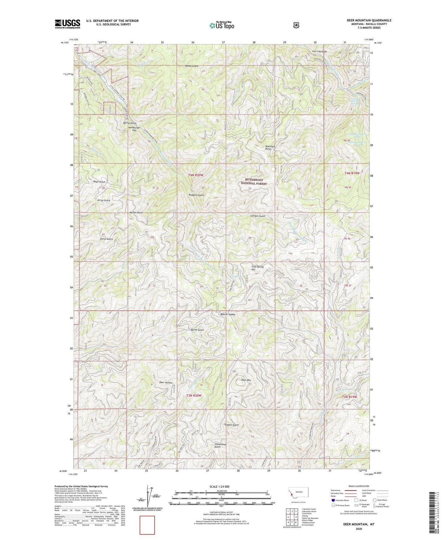
Deer Mountain Montana US Topo Map
Couldn't load pickup availability
Also explore the Deer Mountain Forest Service Topo of this same quad for updated USFS data
2024 topographic map quadrangle Deer Mountain in the state of Montana. Scale: 1:24000. Based on the newly updated USGS 7.5' US Topo map series, this map is in the following counties: Ravalli. The map contains contour data, water features, and other items you are used to seeing on USGS maps, but also has updated roads and other features. This is the next generation of topographic maps. Printed on high-quality waterproof paper with UV fade-resistant inks.
Quads adjacent to this one:
West: Darby
Northwest: Hamilton South
North: Mountain House
Northeast: Gird Point
East: Bald Top Mountain
Southeast: French Basin
South: Robbins Gulch
Southwest: Burnt Ridge
This map covers the same area as the classic USGS quad with code o46114a1.
Contains the following named places: 04N19W07DCD_01 Spring, 04N19W07DCD_02 Spring, Blacktail Point, Bobcat Saddle, Cat House Creek, Cold Spring Hill, Cold Springs, Deer Mountain, Hamburger Flat, Harlan Point, Jack Creek, Lairdon Gulch, Last Log Draw, Ravalli County, Rodgers Gulch, Sleeping Child Hot Springs, Sleeping Child School, South Fork Little Sleeping Child Creek, Spring Gulch, Two Bear Creek