MyTopo
Busby Montana US Topo Map
Couldn't load pickup availability
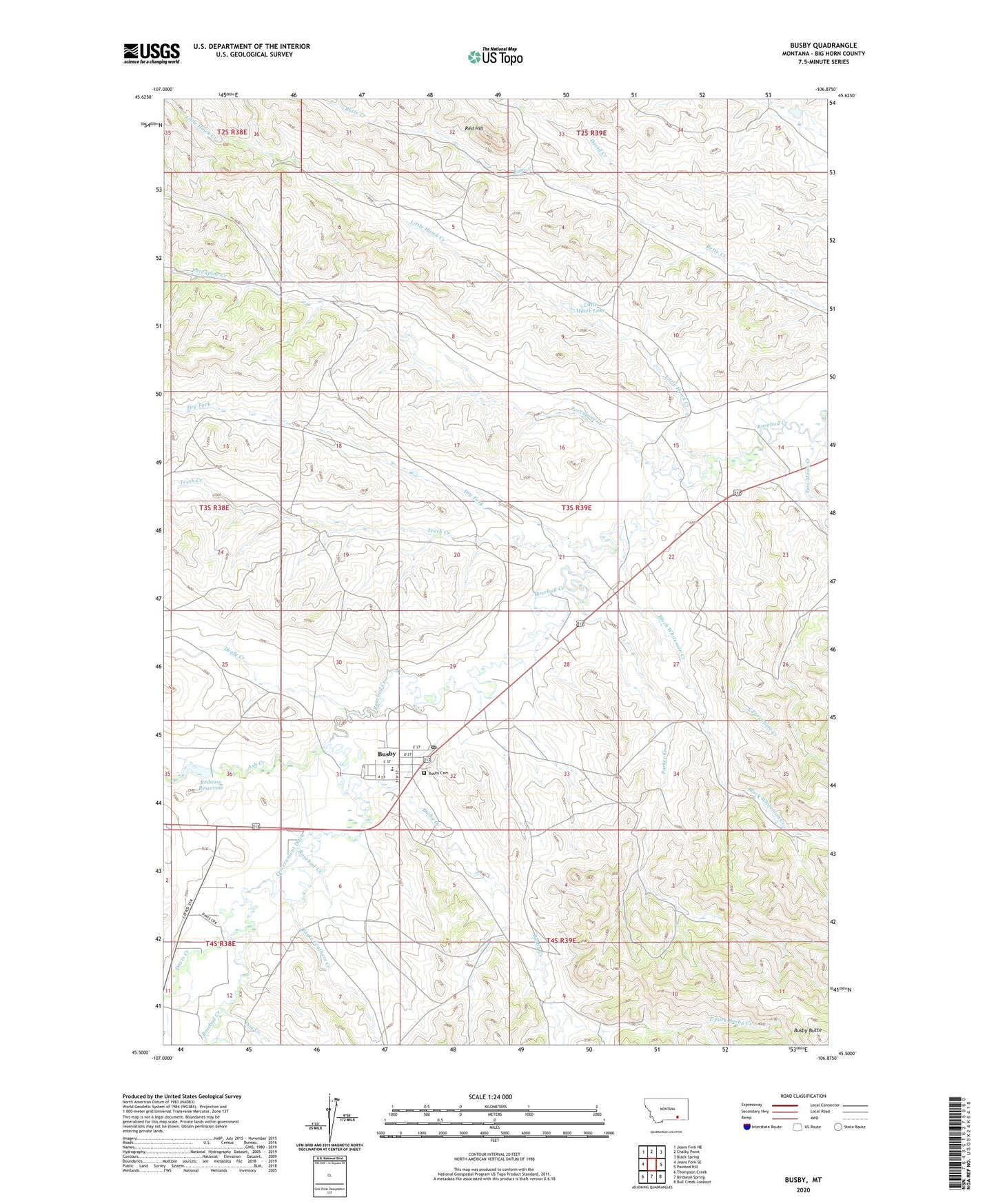
2020 topographic map quadrangle Busby in the state of Montana. Scale: 1:24000. Based on the newly updated USGS 7.5' US Topo map series, this map is in the following counties: Big Horn. The map contains contour data, water features, and other items you are used to seeing on USGS maps, but also has updated roads and other features. This is the next generation of topographic maps. Printed on high-quality waterproof paper with UV fade-resistant inks.
Quads adjacent to this one:
West: Jeans Fork SE
Northwest: Jeans Fork NE
North: Chalky Point
Northeast: Black Spring
East: Painted Hill
Southeast: Bull Creek Lookout
South: Birdseye Spring
Southwest: Thompson Creek
Contains the following named places: 03S38E36BDD_01 Well, 03S39E03DBDD01 Well, 03S39E06ABDD01 Well, 03S39E07BACB01 Well, 03S39E28CAAC01 Well, 03S39E29DDCA01 Well, 03S39E31BDDD01 Well, 03S39E31DBAA01 Well, 03S39E31DBAB01 Well, 03S39E32ABAC01 Well, 03S39E32BCAC01 Well, 03S39E33CCDC01 Well, 03S39E34CDCC01 Well, 04S38E01ABBD01 Well, 04S39E09BADA01 Well, 04S39E09DDAA01 Well, 04S39E09DDBA01 Well, 04S46E01DDCA01 Well, Ash Creek, Black Whiteman Creek, Busby, Busby Butte, Busby Cemetery, Busby Census Designated Place, Busby Creek, Busby District, Busby Mine, Busby Post Office, Christ the King Church, Davis Creek, Deafy Creek, Dog Creek, Dry Fork, Eagle Feathers Creek, East Fork Busby Creek, East Porcupine Creek, Government Ditch, Indian Chief Two Moons Historical Monument, Little Hawk Creek, Little Hawk Lake, North Fork Butte Creek, Northern Cheyenne Reservation Division, Northern Cheyenne Tribal School, Parker Creek, Porcupine Creek, Red Hill, Rednose Dam, Rednose Reservoir, Teeth Creek, Two Moon Creek, White River Mennonite Church, Wood Gulch Dam