MyTopo
Painted Hill Montana US Topo Map
Couldn't load pickup availability
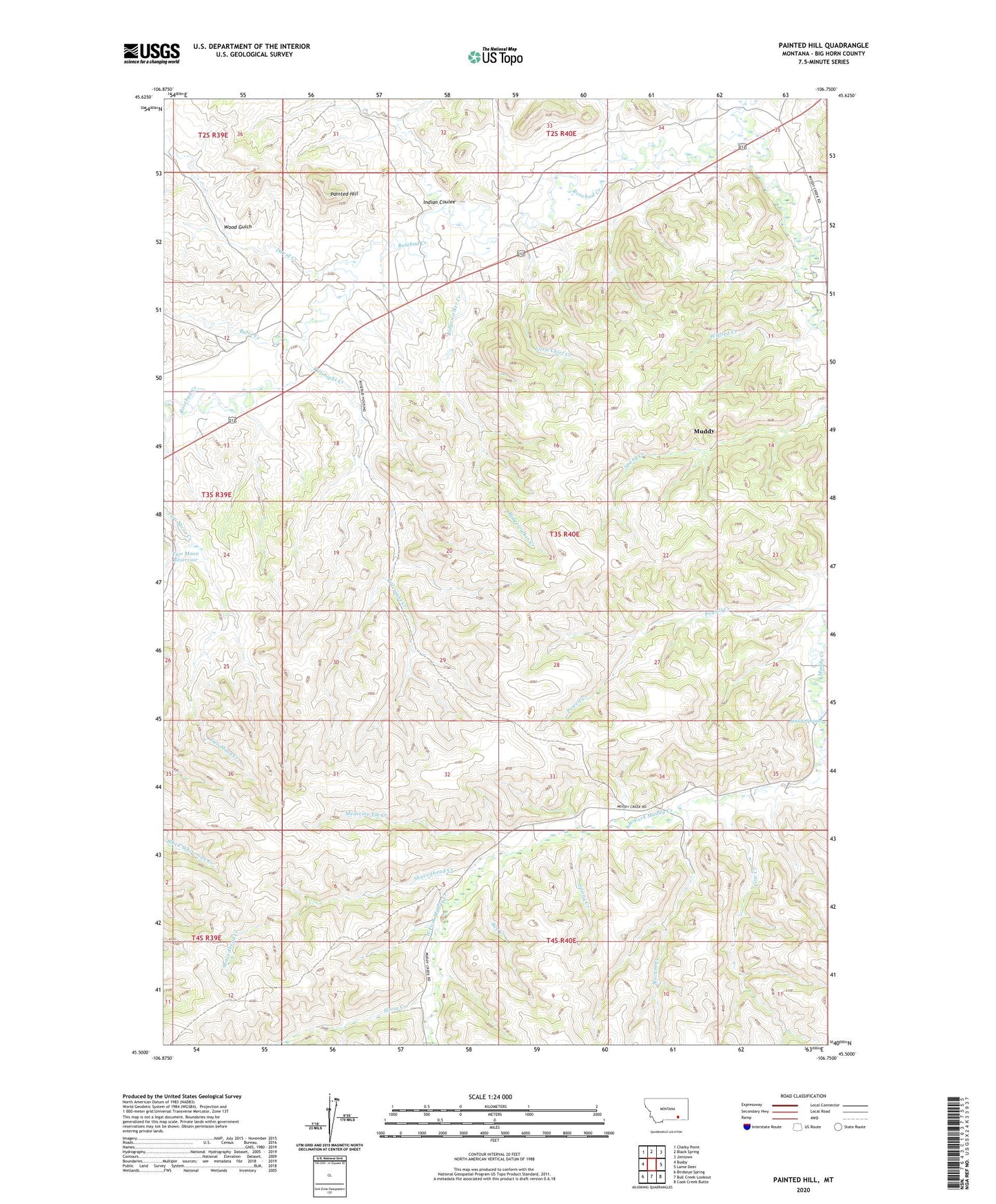
2024 topographic map quadrangle Painted Hill in the state of Montana. Scale: 1:24000. Based on the newly updated USGS 7.5' US Topo map series, this map is in the following counties: Big Horn. The map contains contour data, water features, and other items you are used to seeing on USGS maps, but also has updated roads and other features. This is the next generation of topographic maps. Printed on high-quality waterproof paper with UV fade-resistant inks.
Quads adjacent to this one:
West: Busby
Northwest: Chalky Point
North: Black Spring
Northeast: Jimtown
East: Lame Deer
Southeast: Cook Creek Butte
South: Bull Creek Lookout
Southwest: Birdseye Spring
This map covers the same area as the classic USGS quad with code o45106e7.
Contains the following named places: 03S40E04ACD_01 Well, 03S40E04ACD_02 Well, 03S40E04ADB_01 Well, 03S40E05CBC_01 Well, 03S40E05CBC_02 Well, 03S40E05DBA_01 Well, 03S40E07BDD_01 Well, 03S40E07CAB_01 Well, 03S40E07CCA_01 Well, 03S40E07CCA_02 Well, 03S40E18DBA_01 Well, 03S40E33DDC_01 Well, 03S40E34CDA_01 Well, Bear Creek, Bee Creek, Butte Creek, Cow Creek, David Creek, East Fork Muddy Creek, Horse Creek, Indian Coulee, Killsnight Creek, Little Chief Creek, Medicine Elk Creek, Muddy, Muddy Census Designated Place, Muddy Creek, Muddy District, Muddy Post Office, Muddy Springs, Painted Hill, Ridgewalker Creek, Shavedhead Creek, Slocum Creek, Spring Creek, Two Moon Reservoir, West Fork Muddy Creek, Whitedirt Creek, Wilfred Creek, Wood Gulch