MyTopo
Chalky Point Montana US Topo Map
Couldn't load pickup availability
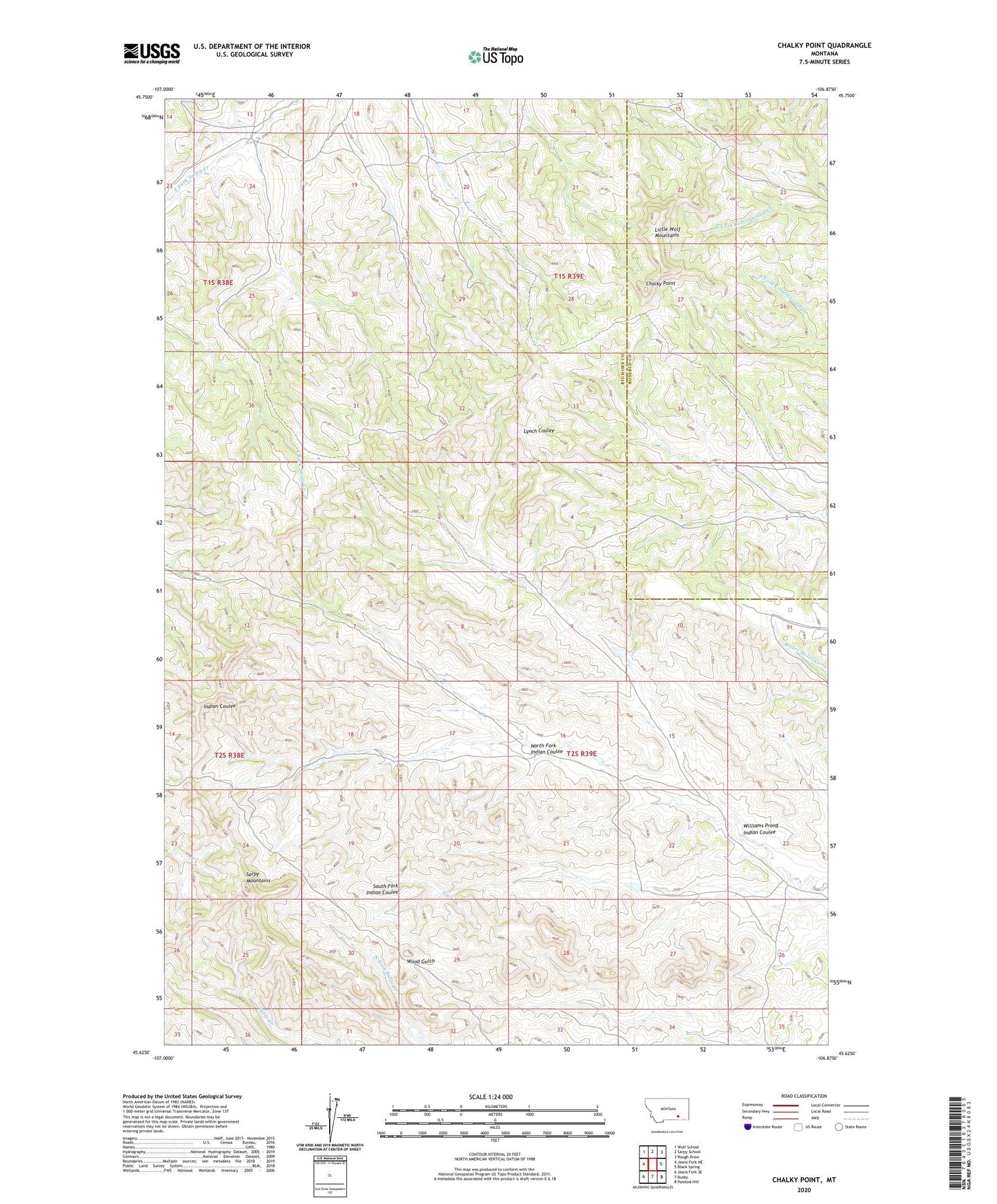
2024 topographic map quadrangle Chalky Point in the state of Montana. Scale: 1:24000. Based on the newly updated USGS 7.5' US Topo map series, this map is in the following counties: Big Horn, Rosebud. The map contains contour data, water features, and other items you are used to seeing on USGS maps, but also has updated roads and other features. This is the next generation of topographic maps. Printed on high-quality waterproof paper with UV fade-resistant inks.
Quads adjacent to this one:
West: Jeans Fork NE
Northwest: Wolf School
North: Sarpy School
Northeast: Rough Draw
East: Black Spring
Southeast: Painted Hill
South: Busby
Southwest: Jeans Fork SE
This map covers the same area as the classic USGS quad with code o45106f8.
Contains the following named places: 02S39E17ADD_01 Well, 02S39E23BCD_01 Well, Chalky Point, Cheyenne Number 5 Dam, North Fork Indian Coulee, Sarpy Mountains, Williams Prong Indian Coulee