MyTopo
Calypso Montana US Topo Map
Couldn't load pickup availability
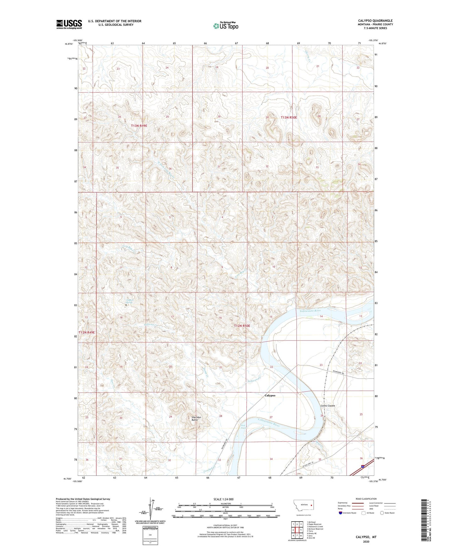
2020 topographic map quadrangle Calypso in the state of Montana. Scale: 1:24000. Based on the newly updated USGS 7.5' US Topo map series, this map is in the following counties: Prairie. The map contains contour data, water features, and other items you are used to seeing on USGS maps, but also has updated roads and other features. This is the next generation of topographic maps. Printed on high-quality waterproof paper with UV fade-resistant inks.
Quads adjacent to this one:
West: McClure Reservoir
Northwest: McCloud
North: Papps Reservoir
Northeast: Diamond G Creek
East: Terry
Southeast: Zero NE
South: Zero
Southwest: Kinsey NE
Contains the following named places: 12N50E22AABB01 Well, 12N50E24CACD01 Well, 12N50E32DAAA01 Well, 12N50E34DACA01 Well, 13N49E24CBBA01 Well, Calipso Bridge, Calypso, Calypso Spring, Calypso Trail, Camp Creek, Coal Mine Creek, Conns Coulee, Cow Creek, Crooked Creek, Deer Creek, Kamm, Lost Boy Creek, North Fork Lost Boy Creek, Prairie County, Sand Creek, Sheridan Butte, Sullivan Creek, Swank Well, Terry Scenic View, Wolf Rapids