MyTopo
Kinsey NE Montana US Topo Map
Couldn't load pickup availability
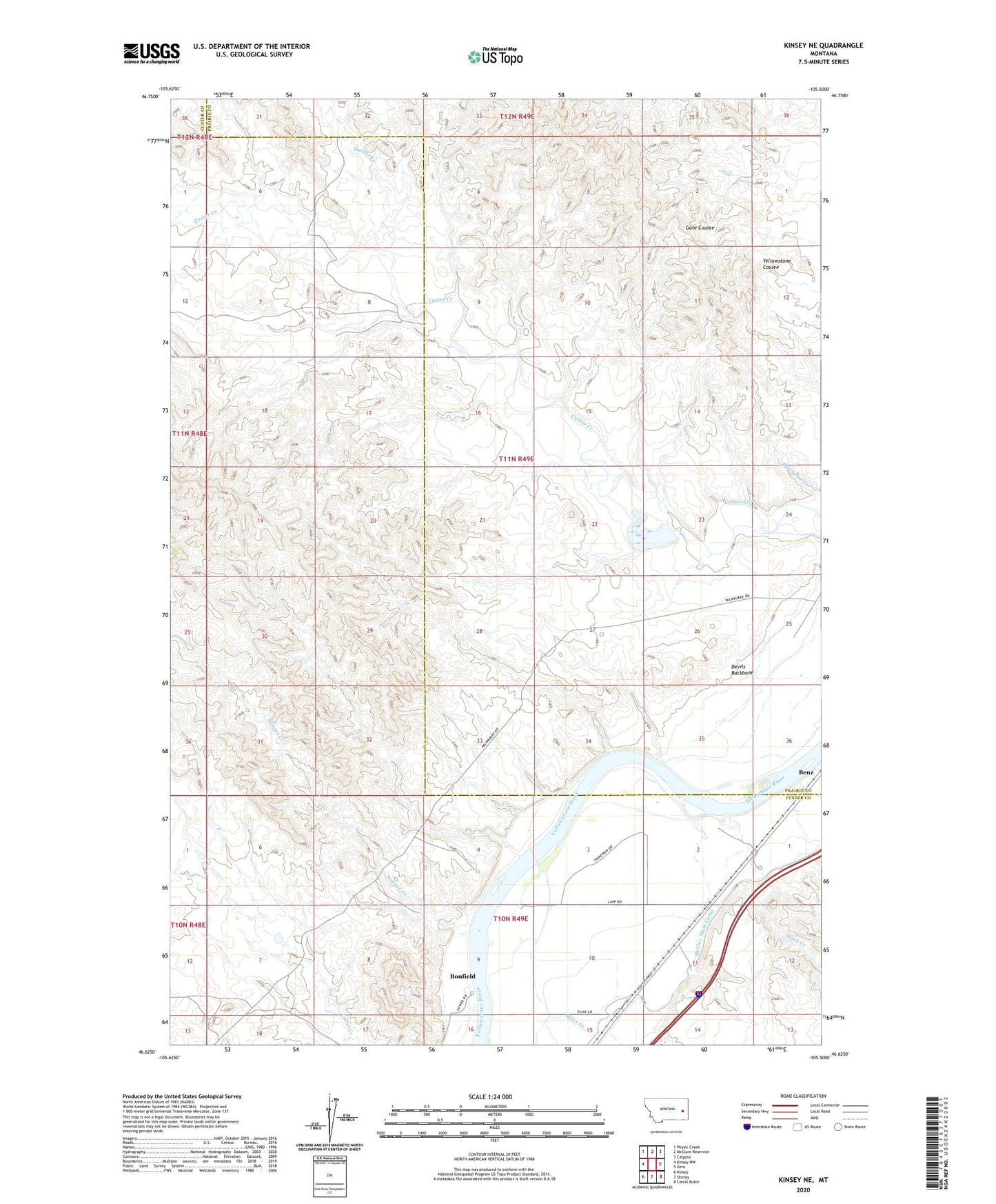
2024 topographic map quadrangle Kinsey NE in the state of Montana. Scale: 1:24000. Based on the newly updated USGS 7.5' US Topo map series, this map is in the following counties: Custer, Prairie. The map contains contour data, water features, and other items you are used to seeing on USGS maps, but also has updated roads and other features. This is the next generation of topographic maps. Printed on high-quality waterproof paper with UV fade-resistant inks.
Quads adjacent to this one:
West: Kinsey NW
Northwest: Physic Creek
North: McClure Reservoir
Northeast: Calypso
East: Zero
Southeast: Corral Butte
South: Shirley
Southwest: Kinsey
This map covers the same area as the classic USGS quad with code o46105f5.
Contains the following named places: 10N49E01BAC_01 Well, 10N49E01CCAC01 Well, 10N49E05DBDC01 Well, 11N49E24ACCC01 Well, Benz, Bonfield, Bonfield Fishing Access Site, Custer Creek Dam, Devils Backbone, Haughian Number 12 Dam, Hunter Creek, Mack Creek, Saugus Creek, Shirley Main Canal, Williams Creek