MyTopo
McClure Reservoir Montana US Topo Map
Couldn't load pickup availability
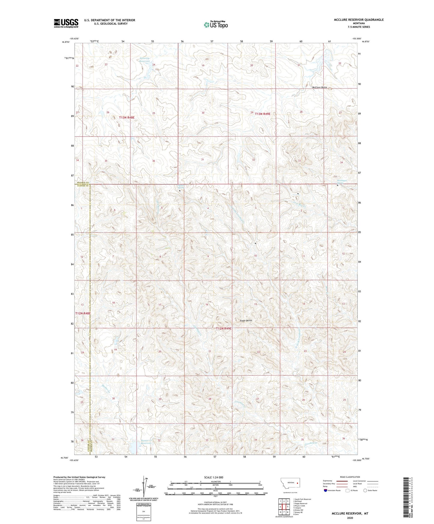
2024 topographic map quadrangle McClure Reservoir in the state of Montana. Scale: 1:24000. Based on the newly updated USGS 7.5' US Topo map series, this map is in the following counties: Prairie, Custer. The map contains contour data, water features, and other items you are used to seeing on USGS maps, but also has updated roads and other features. This is the next generation of topographic maps. Printed on high-quality waterproof paper with UV fade-resistant inks.
Quads adjacent to this one:
West: Physic Creek
Northwest: South Fork Reservoir
North: McCloud
Northeast: Papps Reservoir
East: Calypso
Southeast: Zero
South: Kinsey NE
Southwest: Kinsey NW
This map covers the same area as the classic USGS quad with code o46105g5.
Contains the following named places: 13N48E26ABDB01 Well, Bn Number 100 Dam, Bootlegger Spring, Eagle Butte, Hawk Dam, Hines Number 1 Dam, Hines Number 2 Dam, Hunter Creek Dam, Hunter Creek Reservoir, Johnson Spring, McClure Butte, McClure Reservoir, Silvertip Dam, Silvertip Reservoir