MyTopo
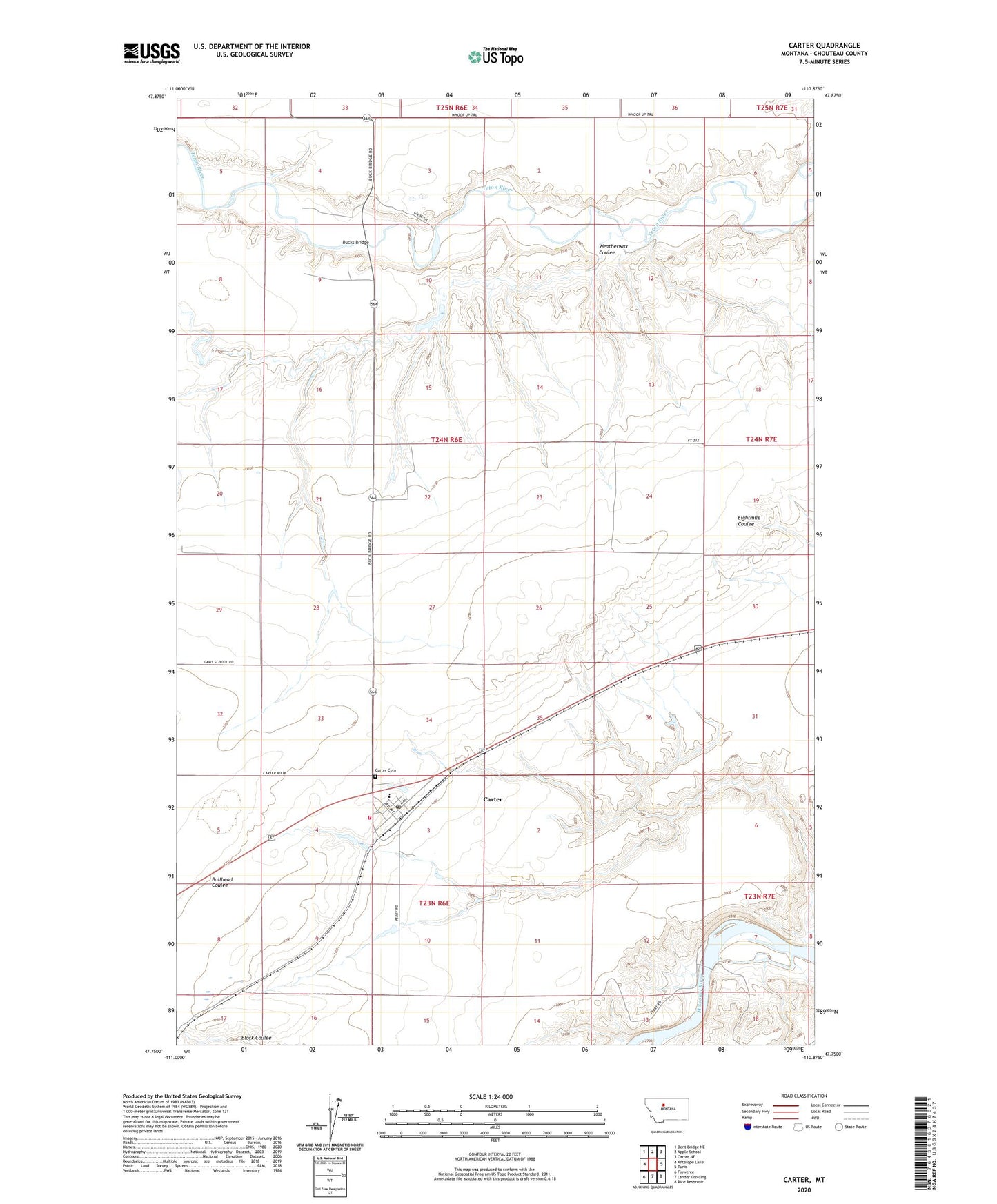
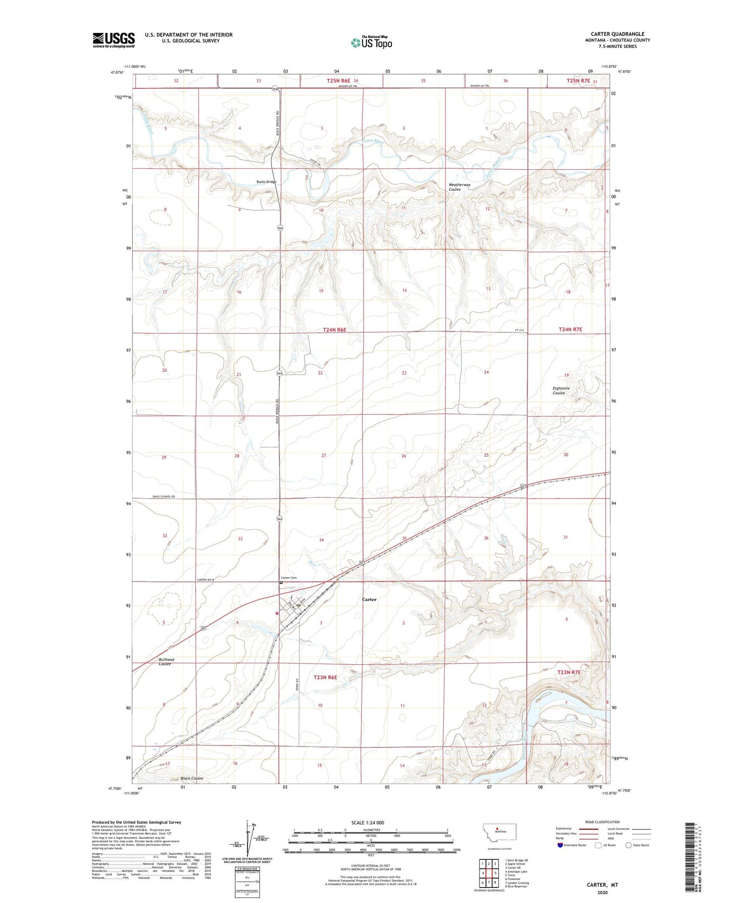
Carter Montana US Topo Map
Couldn't load pickup availability
2020 topographic map quadrangle Carter in the state of Montana. Scale: 1:24000. Based on the newly updated USGS 7.5' US Topo map series, this map is in the following counties: Chouteau. The map contains contour data, water features, and other items you are used to seeing on USGS maps, but also has updated roads and other features. This is the next generation of topographic maps. Printed on high-quality waterproof paper with UV fade-resistant inks.
Quads adjacent to this one:
West: Antelope Lake
Northwest: Dent Bridge NE
North: Apple School
Northeast: Carter NE
East: Tunis
Southeast: Rice Reservoir
South: Lander Crossing
Southwest: Floweree
Contains the following named places: 23N06E03BBDA01 Well, 24N06E10BCBA01 Well, 24N06E15CDCD01 Well, 24N06E28ADBC01 Well, 24N06E28DCCD01 Well, 24N06E34CDAC01 Well, 25N06E35DCCA01 Well, Baack School, Bees Hive Dam, Bucks Bridge, Carter, Carter Cemetery, Carter Census Designated Place, Carter City Park, Carter Ferry, Carter Ferry Fishing Access Site, Carter Methodist Church, Carter Post Office, Carter School, Carter Volunteer Fire Company, Farmers Elevator, General Mills Incorporated Elevator, Greeley Elevator, O'Reilly School, Presbyterian Church, Rocky Mountain Elevator, Saint Margaret Church, State Elevator, Weatherwax Coulee