MyTopo
Lander Crossing Montana US Topo Map
Couldn't load pickup availability
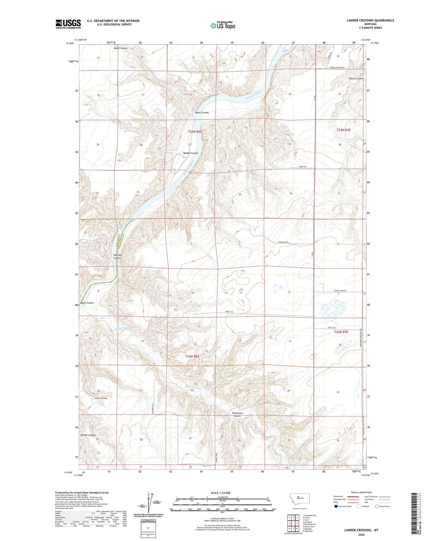
2024 topographic map quadrangle Lander Crossing in the state of Montana. Scale: 1:24000. Based on the newly updated USGS 7.5' US Topo map series, this map is in the following counties: Chouteau, Cascade. The map contains contour data, water features, and other items you are used to seeing on USGS maps, but also has updated roads and other features. This is the next generation of topographic maps. Printed on high-quality waterproof paper with UV fade-resistant inks.
Quads adjacent to this one:
West: Floweree
Northwest: Antelope Lake
North: Carter
Northeast: Tunis
East: Rice Reservoir
Southeast: Highwood
South: Waltham
Southwest: Morony Dam
This map covers the same area as the classic USGS quad with code o47110f8.
Contains the following named places: 22N06E09DDAB01 Well, 22N06E10CD__01 Well, 22N07E07BCCA01 Well, Black Coulee, Highwood Creek, Huntley Coulee, Lander Crossing, Middle Coulee, Ryan Coulee, Tueverson Coulee