MyTopo
Floweree Montana US Topo Map
Couldn't load pickup availability
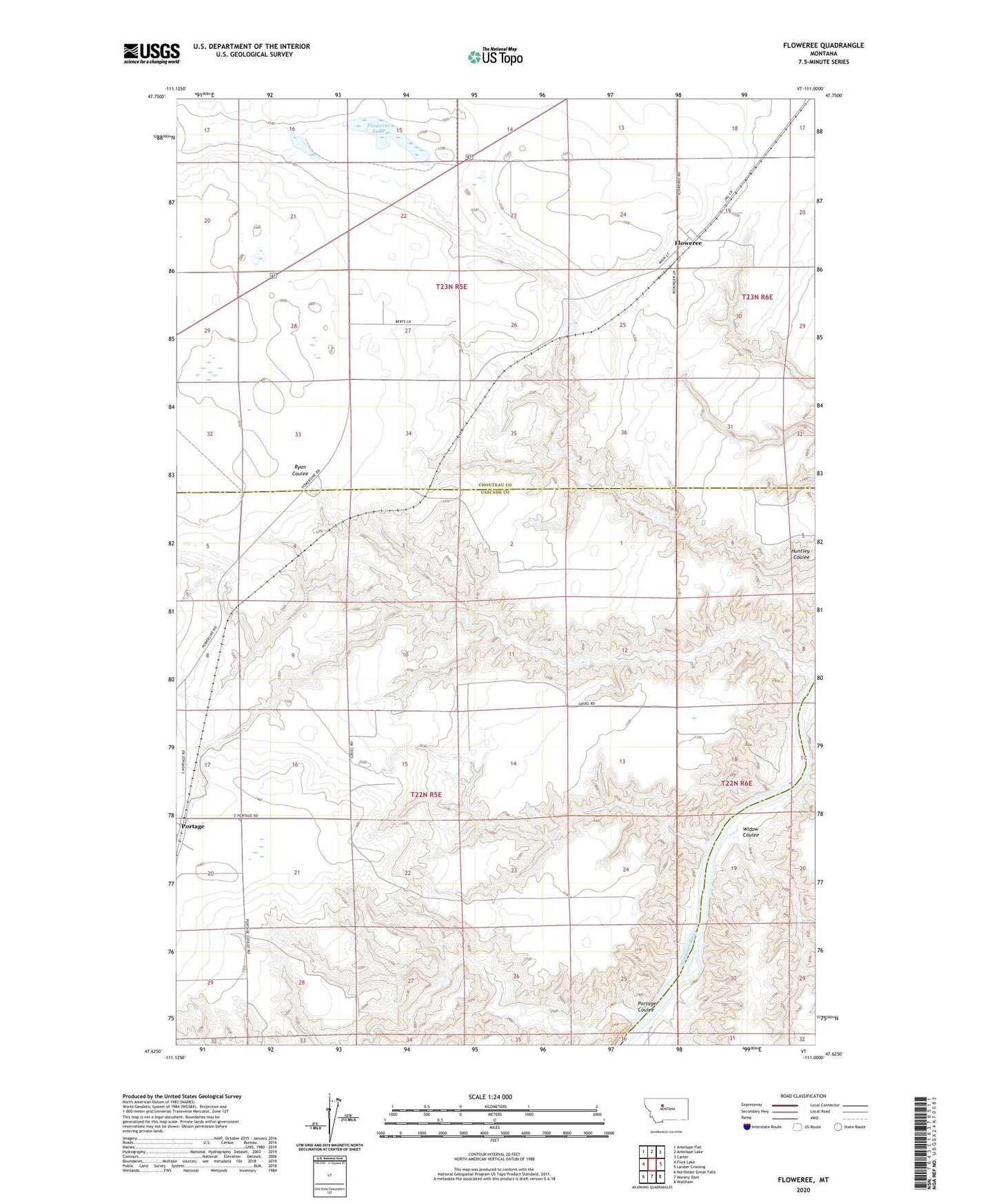
2024 topographic map quadrangle Floweree in the state of Montana. Scale: 1:24000. Based on the newly updated USGS 7.5' US Topo map series, this map is in the following counties: Cascade, Chouteau. The map contains contour data, water features, and other items you are used to seeing on USGS maps, but also has updated roads and other features. This is the next generation of topographic maps. Printed on high-quality waterproof paper with UV fade-resistant inks.
Quads adjacent to this one:
West: Flick Lake
Northwest: Antelope Flat
North: Antelope Lake
Northeast: Carter
East: Lander Crossing
Southeast: Waltham
South: Morony Dam
Southwest: Northeast Great Falls
This map covers the same area as the classic USGS quad with code o47111f1.
Contains the following named places: Benton Lake Elementary School, Donnelly School, Fitzgerald School, Floweree, Floweree Census Designated Place, Floweree Lake, Floweree Post Office, Floweree School, Lars Dam, Portage, Portage Coulee, Portage Post Office, Robertson Dam, Widow Coulee