MyTopo
Casey Peak Montana US Topo Map
Couldn't load pickup availability
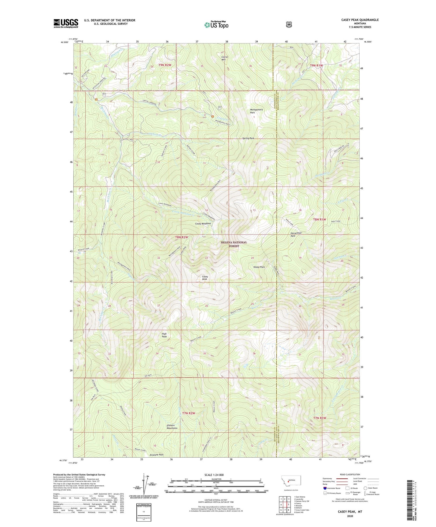
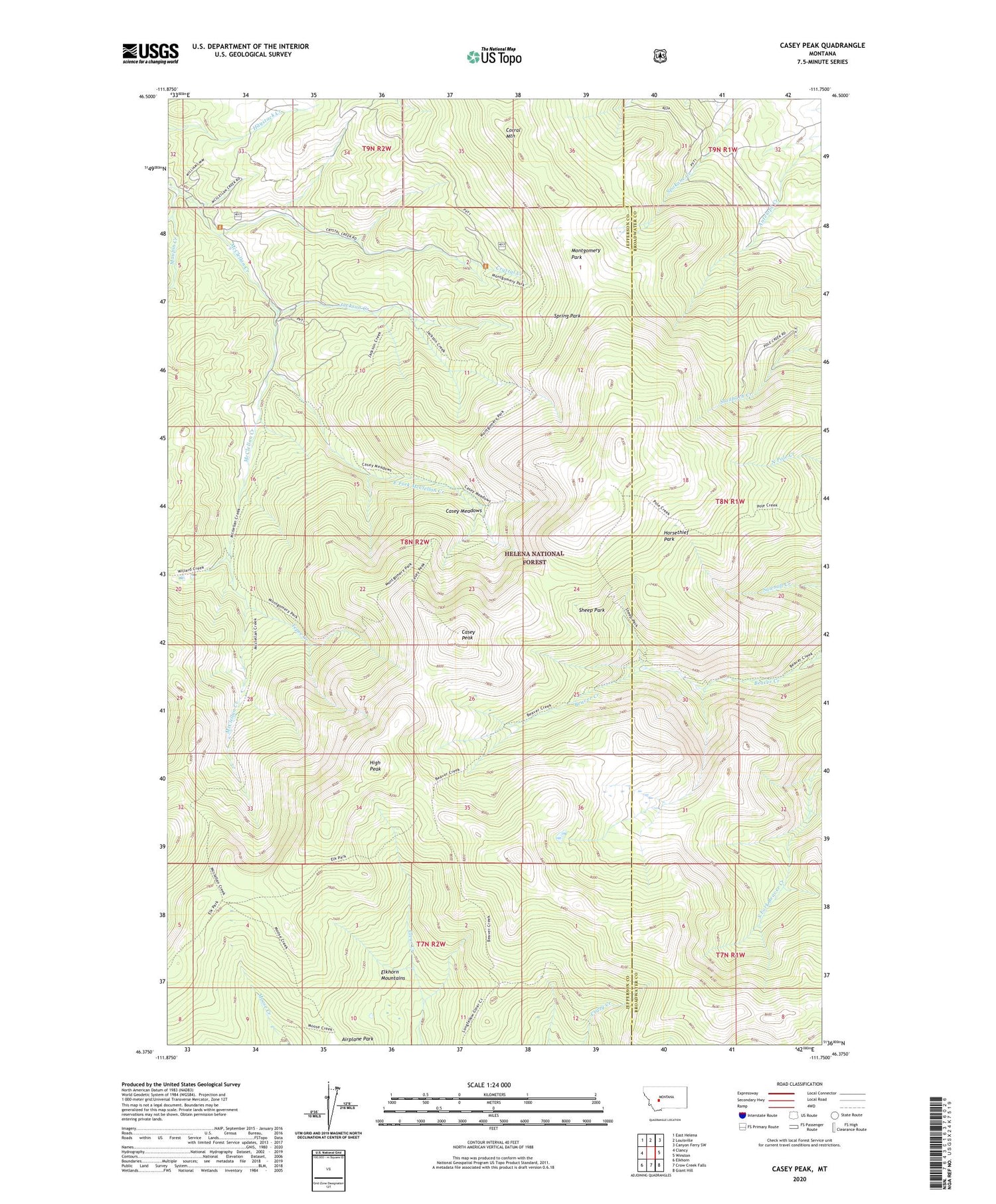
2020 topographic map quadrangle Casey Peak in the state of Montana. Scale: 1:24000. Based on the newly updated USGS 7.5' US Topo map series, this map is in the following counties: Jefferson, Broadwater. The map contains contour data, water features, and other items you are used to seeing on USGS maps, but also has updated roads and other features. This is the next generation of topographic maps. Printed on high-quality waterproof paper with UV fade-resistant inks.
Quads adjacent to this one:
West: Clancy
Northwest: East Helena
North: Louisville
Northeast: Canyon Ferry SW
East: Winston
Southeast: Giant Hill
South: Crow Creek Falls
Southwest: Elkhorn
Contains the following named places: Airplane Park, Casey Meadows, Casey Peak, Corral Mountain, Crystal Creek, Crystal Creek Mine, East Fork McClellan Creek, High Peak, Horsethief Park, Jackson Creek, Maupin Creek, Montgomery Park, NW SE Section 9 Mine, Sheep Park, Spring Park, Tepee Creek, Willard Creek