MyTopo
Canyon Ferry SW Montana US Topo Map
Couldn't load pickup availability
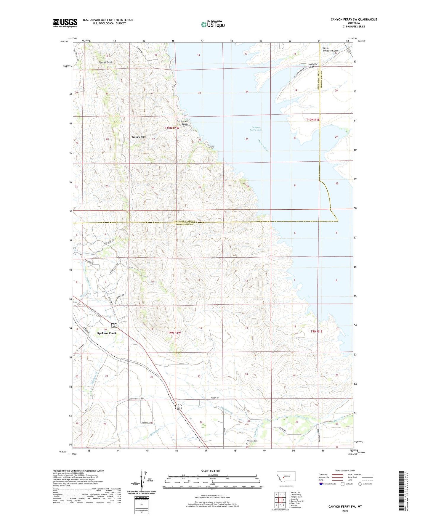
2024 topographic map quadrangle Canyon Ferry SW in the state of Montana. Scale: 1:24000. Based on the newly updated USGS 7.5' US Topo map series, this map is in the following counties: Broadwater, Lewis and Clark. The map contains contour data, water features, and other items you are used to seeing on USGS maps, but also has updated roads and other features. This is the next generation of topographic maps. Printed on high-quality waterproof paper with UV fade-resistant inks.
Quads adjacent to this one:
West: Louisville
Northwest: Hauser Lake
North: Canyon Ferry
Northeast: Hellgate Gulch
East: Canyon Ferry SE
Southeast: Townsend NE
South: Winston
Southwest: Casey Peak
This map covers the same area as the classic USGS quad with code o46111e6.
Contains the following named places: 09N01W22AD__01 Well, 09N01W22CD__01 Well, 09N01W26AD__03 Well, 09N01W26DD__01 Well, 09N01W26DD__02 Well, 10N01W23CCAD01 Well, Antelope Creek, Avalanche Creek, Crittenden Campground, Crittenden Gulch, Hellgate Campground, Hellgate Gulch, Lewis and Clark Picnic Area, Little Hellgate Gulch, Lorelei Picnic Area, Miller Creek, Morans Spur, Orchard Picnic Area, Potter Dam, Potter Irrigation Dam, Sheep Creek, Spokane, Spokane Creek Census Designated Place, Spokane Hills, Spokane Post Office, Staubach Creek, Winston Cemetery