MyTopo
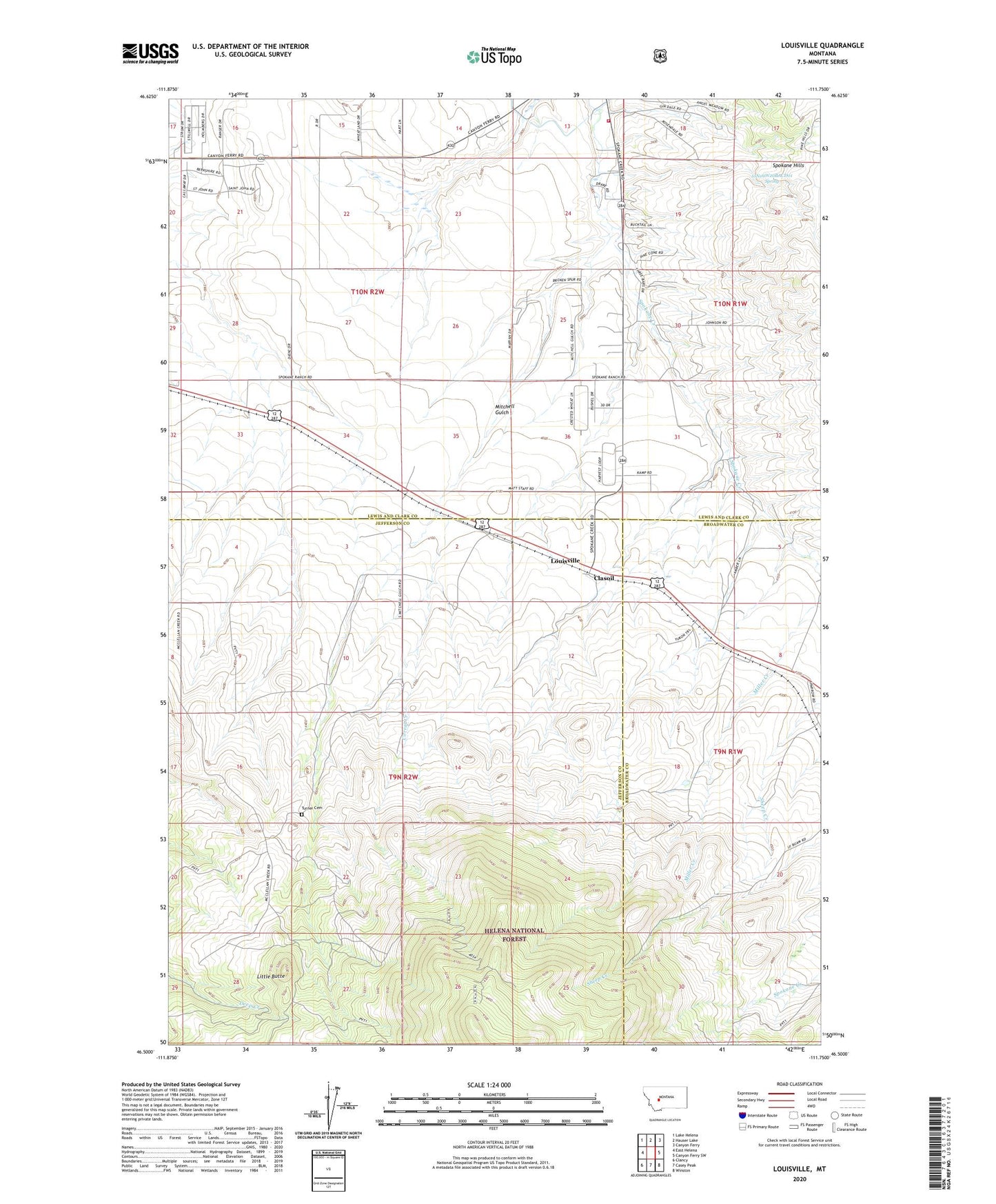
Louisville Montana US Topo Map
Couldn't load pickup availability
Also explore the Louisville Forest Service Topo of this same quad for updated USFS data
2024 topographic map quadrangle Louisville in the state of Montana. Scale: 1:24000. Based on the newly updated USGS 7.5' US Topo map series, this map is in the following counties: Lewis and Clark, Jefferson, Broadwater. The map contains contour data, water features, and other items you are used to seeing on USGS maps, but also has updated roads and other features. This is the next generation of topographic maps. Printed on high-quality waterproof paper with UV fade-resistant inks.
Quads adjacent to this one:
West: East Helena
Northwest: Lake Helena
North: Hauser Lake
Northeast: Canyon Ferry
East: Canyon Ferry SW
Southeast: Winston
South: Casey Peak
Southwest: Clancy
This map covers the same area as the classic USGS quad with code o46111e7.
Contains the following named places: 09N02E26AD__01 Well, 10N02W32AADA01 Well, 10N09W20BACD01 Spring, 59635, Chicago Mine, Clasoil, Clasoil Post Office, Corral Creek, Economy Mine, Little Butte, Louisville, Mitchell, Mitchell Gulch, Penwell, Spokane Creek School, Tri - Lakes Volunteer Fire Department Station 3, Turner Cemetery