MyTopo
Catlin Spring Montana US Topo Map
Couldn't load pickup availability
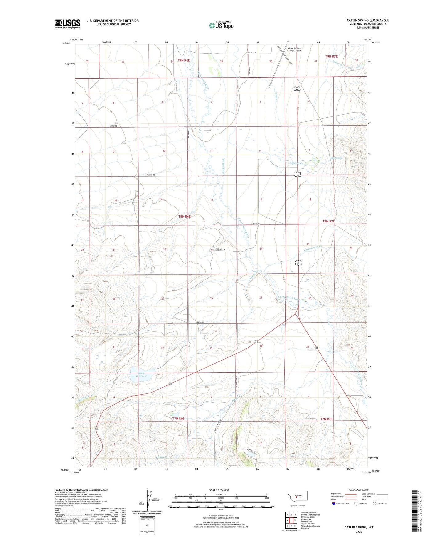
2020 topographic map quadrangle Catlin Spring in the state of Montana. Scale: 1:24000. Based on the newly updated USGS 7.5' US Topo map series, this map is in the following counties: Meagher. The map contains contour data, water features, and other items you are used to seeing on USGS maps, but also has updated roads and other features. This is the next generation of topographic maps. Printed on high-quality waterproof paper with UV fade-resistant inks.
Quads adjacent to this one:
West: Alkali Lake
Northwest: Hanson Reservoir
North: White Sulphur Springs
Northeast: Pinchout Creek
East: Manger Park
Southeast: Ringling
South: Black Butte Mountain
Southwest: Battle Mountain
Contains the following named places: 07N06E11BD__01 Well, 07N07E06BA__01 Well, 08N06E01A___01 Well, 08N06E04AC__01 Well, 08N06E14BB__01 Well, 08N06E14CB__01 Well, 08N06E16AD__01 Well, 08N06E27CC__01 Well, 08N06E27DB__01 Well, 08N06E34DD__01 Well, 08N06E36BB__01 Well, Calkins, Calkins Post Office, Calkins School, Catlin, Catlin Spring, Cottonwood Creek, Fords Creek, Hussey Creek, Mayns Creek, Mayns Dam, Potter Creek, Prairie Creek, Smith River Valley Historical Marker, Spring Creek, Sterret Dam, Wertz Reservoir