MyTopo
Black Butte Mountain Montana US Topo Map
Couldn't load pickup availability
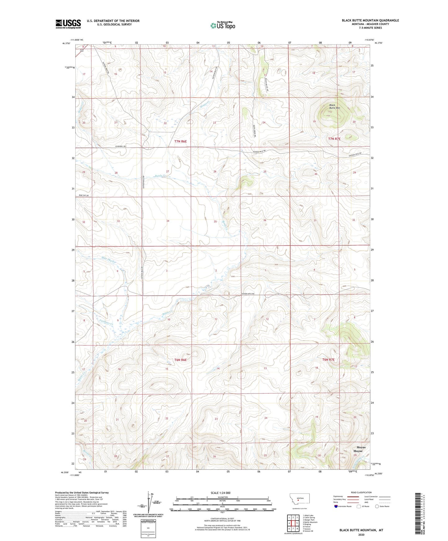
2024 topographic map quadrangle Black Butte Mountain in the state of Montana. Scale: 1:24000. Based on the newly updated USGS 7.5' US Topo map series, this map is in the following counties: Meagher. The map contains contour data, water features, and other items you are used to seeing on USGS maps, but also has updated roads and other features. This is the next generation of topographic maps. Printed on high-quality waterproof paper with UV fade-resistant inks.
Quads adjacent to this one:
West: Battle Mountain
Northwest: Alkali Lake
North: Catlin Spring
Northeast: Manger Park
East: Ringling
Southeast: Sixteen NE
South: Sixteen
Southwest: Francis
This map covers the same area as the classic USGS quad with code o46110c8.
Contains the following named places: A-C Ranch Mine, Badger Creek, Black Butte Mountain, Copper Mine, Faulkner Creek, J Stewart Ranch, Mike Day Creek, Minden Post Office, Moyne, Prescott Ranch