MyTopo
Hanson Reservoir Montana US Topo Map
Couldn't load pickup availability
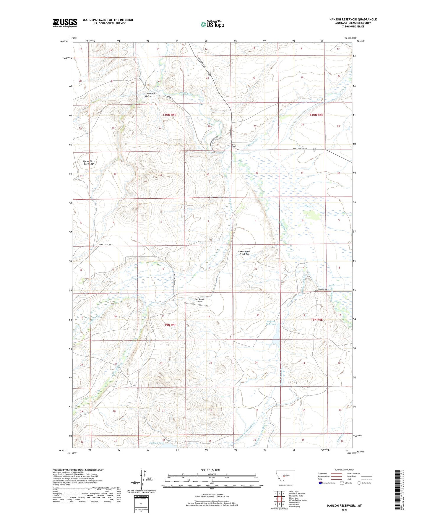
2024 topographic map quadrangle Hanson Reservoir in the state of Montana. Scale: 1:24000. Based on the newly updated USGS 7.5' US Topo map series, this map is in the following counties: Meagher. The map contains contour data, water features, and other items you are used to seeing on USGS maps, but also has updated roads and other features. This is the next generation of topographic maps. Printed on high-quality waterproof paper with UV fade-resistant inks.
Quads adjacent to this one:
West: Gipsy Lake
Northwest: Fort Logan
North: Whitetail Reservoir
Northeast: Coxcombe Butte
East: White Sulphur Springs
Southeast: Catlin Spring
South: Alkali Lake
Southwest: Mount Edith
This map covers the same area as the classic USGS quad with code o46111e1.
Contains the following named places: 09N05E10BB__01 Well, 10N05E22B___01 Well, 10N05E25CA__01 Well, 10N05E25DD__01 Well, 10N06E30DA__01 Well, Big Birch Creek, Fox Creek, Galt Ranch Airport, Hanson Reservoir, Hanson Reservoir Dam, Langford City, Little Birch Creek, Lower Birch Creek Bar, Mud Creek, Newlan Creek, North Fork Woods Gulch Creek, Onondago Post Office, South Fork Woods Gulch Creek, Thompson Gulch, Woods Gulch Creek