MyTopo
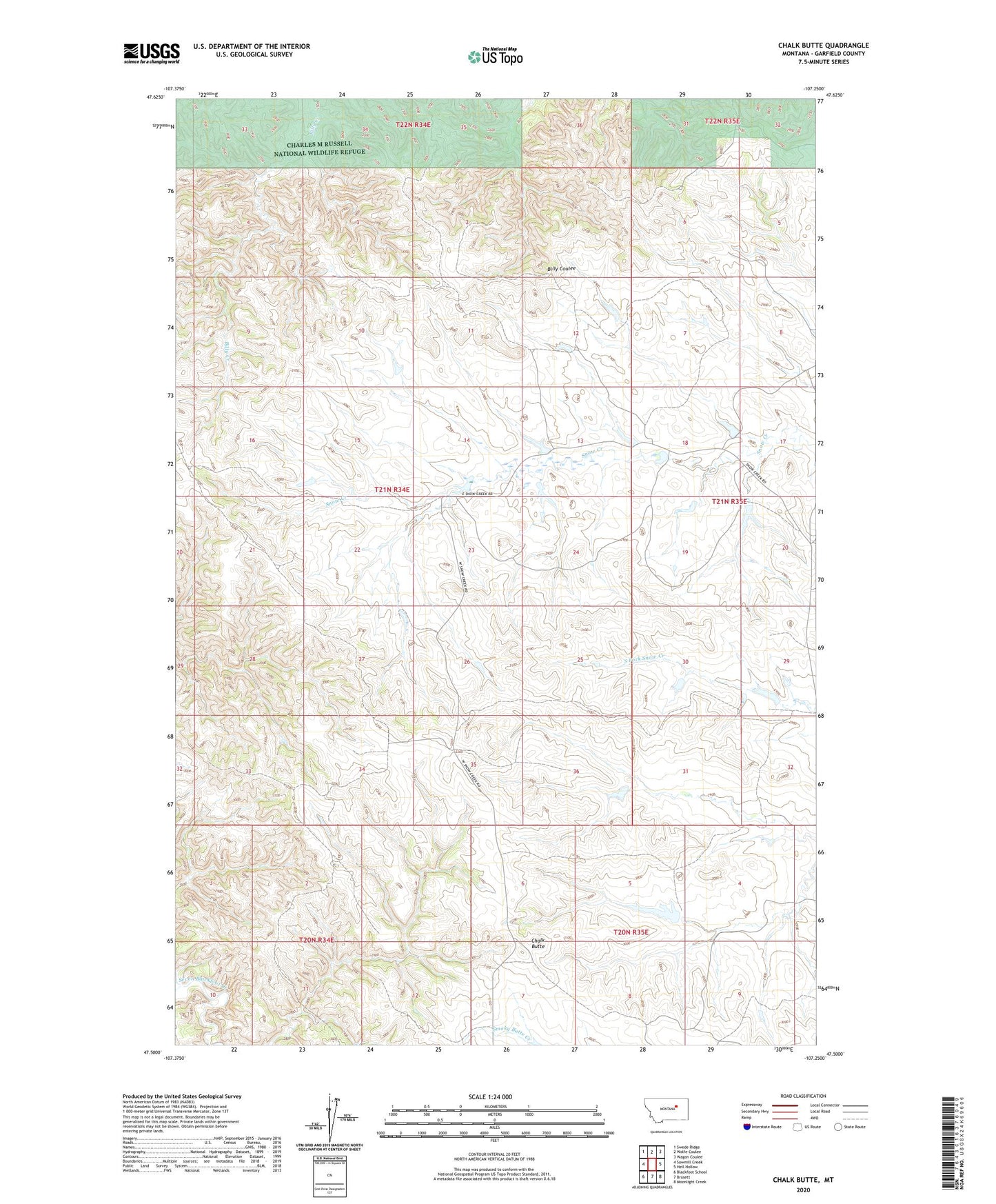
Chalk Butte Montana US Topo Map
Couldn't load pickup availability
2024 topographic map quadrangle Chalk Butte in the state of Montana. Scale: 1:24000. Based on the newly updated USGS 7.5' US Topo map series, this map is in the following counties: Garfield. The map contains contour data, water features, and other items you are used to seeing on USGS maps, but also has updated roads and other features. This is the next generation of topographic maps. Printed on high-quality waterproof paper with UV fade-resistant inks.
Quads adjacent to this one:
West: Sawmill Creek
Northwest: Swede Ridge
North: Wolfe Coulee
Northeast: Wagon Coulee
East: Hell Hollow
Southeast: Moonlight Creek
South: Brusett
Southwest: Blackfoot School
This map covers the same area as the classic USGS quad with code o47107e3.
Contains the following named places: Bragg Number 1 Dam, Chalk Butte, Chalk Number 1 Dam, Coulter Number 1 Dam, Coulter Number 2 Dam, Frank McKeever Number 1 Dam, Frank McKeever Number 2 Dam, Hauso Reservoir Dam, Iverson Ranch, McKeever Reservoir Dam, Watt Dam, Watt Number 2 Dam