MyTopo
Chimney Creek Montana US Topo Map
Couldn't load pickup availability
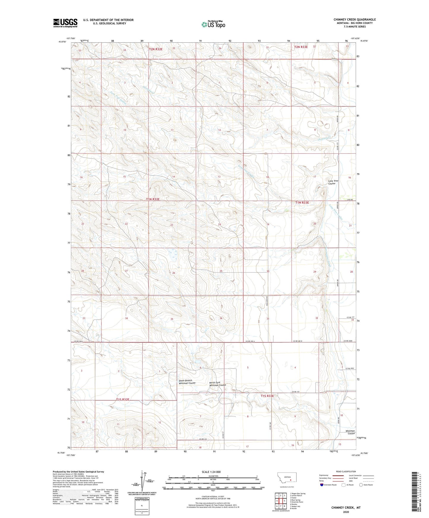
2024 topographic map quadrangle Chimney Creek in the state of Montana. Scale: 1:24000. Based on the newly updated USGS 7.5' US Topo map series, this map is in the following counties: Big Horn. The map contains contour data, water features, and other items you are used to seeing on USGS maps, but also has updated roads and other features. This is the next generation of topographic maps. Printed on high-quality waterproof paper with UV fade-resistant inks.
Quads adjacent to this one:
West: Blue Spring
Northwest: Wagon Box Spring
North: Lemon Ranch
Northeast: Foster
East: Ninemile Point
Southeast: Hardin
South: Walker Hill
Southwest: Rowley
This map covers the same area as the classic USGS quad with code o45107g6.
Contains the following named places: 01N33E20CD__01 Well, 01N33E31CDA_01 Well, 01N33E31DC__01 Well, 01N33E32ADDD01 Well, 01N38E29ADCC01 Well, 01S33E08BCC_01 Well, 01S33E10CD__01 Well, 01S33E10CDB_01 Well, Lone Tree Coulee, North Fork Whitman Coulee, Raglands Number 1 Dam, South Branch Whitman Coulee, Two Leggins Canal