MyTopo
Christina Montana US Topo Map
Couldn't load pickup availability
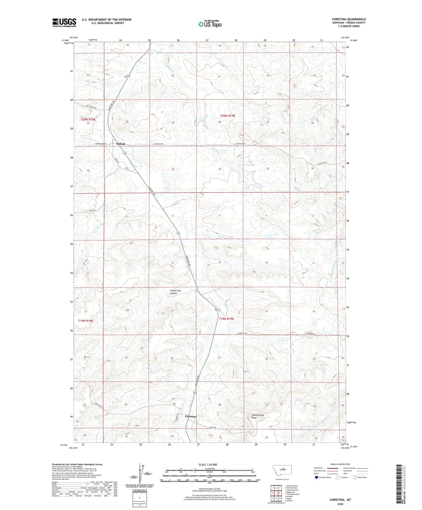
2024 topographic map quadrangle Christina in the state of Montana. Scale: 1:24000. Based on the newly updated USGS 7.5' US Topo map series, this map is in the following counties: Fergus. The map contains contour data, water features, and other items you are used to seeing on USGS maps, but also has updated roads and other features. This is the next generation of topographic maps. Printed on high-quality waterproof paper with UV fade-resistant inks.
Quads adjacent to this one:
West: Hilger NW
Northwest: Winifred West
North: Winifred East
Northeast: Gerhard Corner
East: The Horse Ranch
Southeast: Armells
South: Hilger
Southwest: Kendall
This map covers the same area as the classic USGS quad with code o47109d3.
Contains the following named places: Alkali Creek, Christina, Christina Post Office, Erie Dam, Freeze Out Coulee, Jimmerson Number 1 Dam, Sheepherder Peak, Suffolk, Suffolk Post Office, Wicker Basket Number 1 Dam