
MyTopo
Circle L Creek Montana US Topo Map
Couldn't load pickup availability
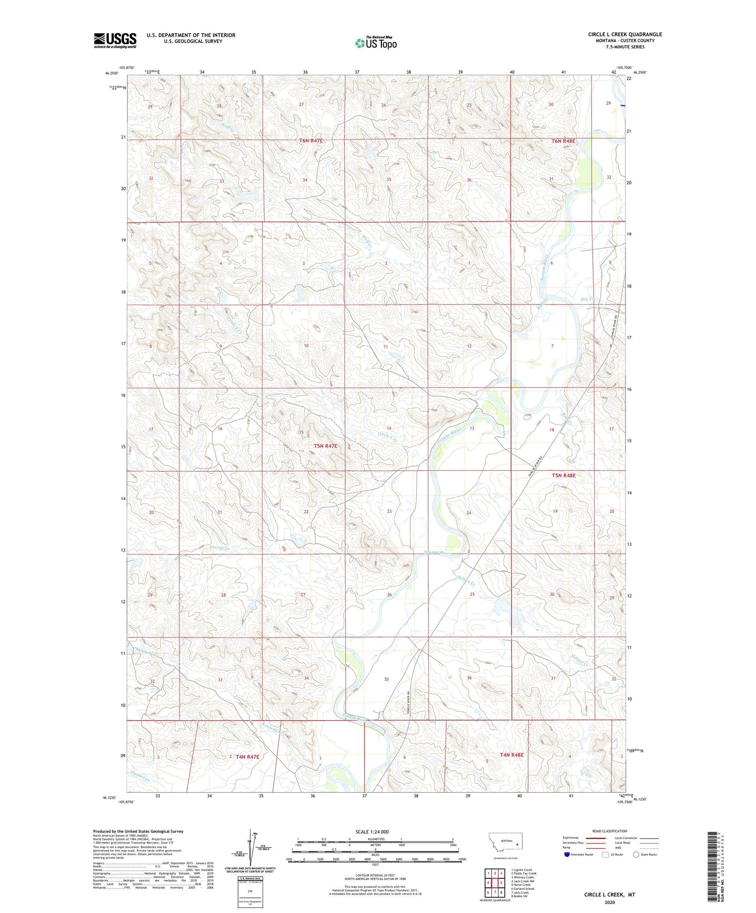
2020 topographic map quadrangle Circle L Creek in the state of Montana. Scale: 1:24000. Based on the newly updated USGS 7.5' US Topo map series, this map is in the following counties: Custer. The map contains contour data, water features, and other items you are used to seeing on USGS maps, but also has updated roads and other features. This is the next generation of topographic maps. Printed on high-quality waterproof paper with UV fade-resistant inks.
Quads adjacent to this one:
West: Jack Creek NW
Northwest: Lignite Creek
North: Paddy Fay Creek
Northeast: Whitney Creek
East: Horse Creek
Southeast: Beebe SW
South: Jack Creek
Southwest: Garland School
Contains the following named places: 04N48E06DACB01 Well, 05N47E25BAAB01 Well, 05N47E26AACA01 Well, 05N48E05BCBB01 Well, 05N48E18ACBC01 Well, Circle L Creek, Dry Creek, Etna, Etna Post Office, Fortune Number 9 Dam, Kennedy Creek, Moffitt Number 1 Dam, Moffitt Number 2 Dam, Nelson Creek, Prat Creek, Thorpe Creek, Wolf Creek, Woodard Number 4 Dam


